Bolinas Ridge, California

Marin County, California
Bolinas Ridge
W. Ridgecrest Blvd
Marin COUNTY
Remote two-lane backroad - PAVEMENT
Many, narrow, blind - CURVES
Fairfax, San Rafael - GAS

Super awesome views overlooking the Pacific Ocean
Quick Ride: One of the most scenic motorcycle roads in the state of California no one has ever heard of. Well worth the ride to seek out this ridgetop road with expansive views of the ocean.
Cushing Amphitheater
Ridgecrest Blvd
Fairfax-Bolinas Rd
Cataract Falls Trail
Lake Alpine
Maps / Comments
My wife worked on Saturdays. I had Saturdays off.
We were newly married and for a short time, Saturdays were all mine. In-between bikes after selling my much-loved ’93 Kawasaki ZX-11D, I began the task of saving up for a Hayabusa. But I had bought a Kawasaki EX500 for my new wife, who had recently gotten her motorcycle endorsement. The Ninja 500 was small, nimble and peppy. But no one was impressed by the Baby Ninja, it was unassuming and even had pink pinstriping.

However, it ran like a sewing machine, and the 16-inch rims made it very nimble on backroads. Each Saturday, while my new wife worked her weekend day shift, I would head out and explore a new set of roads with the EX500. The rule was I had to be back before she was home from work, which meant a little over 8-hour ride. Four hours out, four hours back created a 4-hour radius from home base.
Back in the olden days, there were no resources online that talked about motorcycle roads, you looked for squiggly lines on a paper map, or you had to buy a book at the local book store. And books about roads in California, I had quite a few of those. My latest new book, Scenic Driving California, had an alluring photo on the cover. I came to learn this photo was a shot of Ridgecrest Blvd north of San Francisco, better known as Bolinas Ridge. This cover photo depicted a curvaceous road atop grass covered rolling hills combined with the mountainous background was too alluring to ignore. I had to go find this road and set out on the baby Ninja one Saturday to ride it. What I discovered was a true gem, and like no other road I had ever ridden in my wandering travels around the state.
Eventually, I did purchase my first Hayabusa, and began taking every Pashnit Tour group to the top of this ridge each time we rode the Northern California motorcycle tour along the Pacific Coastline.

Bolinas Ridge on cover of book,
Scenic Driving California

Pashnit Tour group re-grouping in heavy fog making the turn off Highway 1 towards Bolinas Ridge
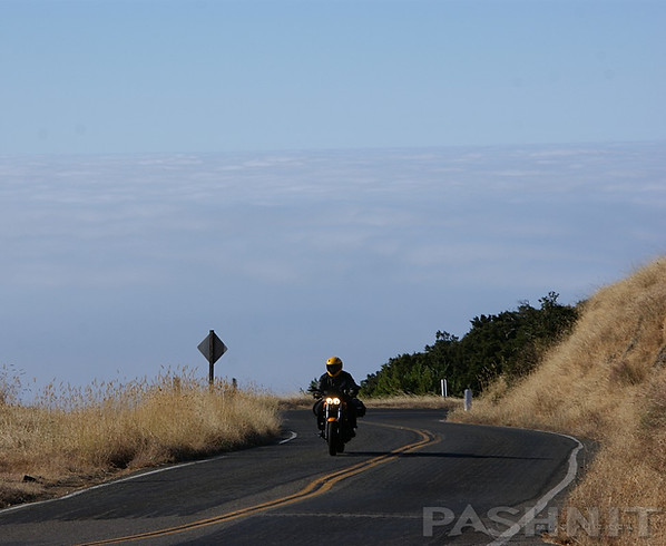
Since that first ride on the Ninja, I have taken countless tour groups to ride atop this ridge, and it has become the first road we ride on every Northern California motorcycle tour I have led for the last twenty plus years. Bolinas Ridge is such a gem, this is not a road you go fast on, rather, the complete opposite.
You go slow.
One purposely crawls along as if attempting to elongate the experience. The view from atop the ridge is so stunning, so unusual, and so unique, a stop along the ridge is mandatory merely to take in the scenic panorama. There are several places to pull over and enjoy the view of the ocean 2000 feet below, plus several hilltops to climb to the top for the best view.
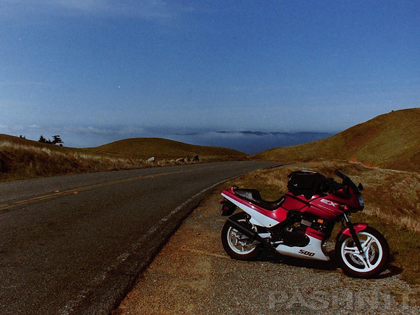
Riding the EX500 for the very first time atop Bolinas Ridge. I've been back more times than I can count.

Easy to miss, especially in heavy fog, the turn onto Panoramic Highway
Bolinas Ridge, quite simply, is a treeless ridgeline running parallel to the Pacific Ocean. At the highest point on this ridge is Mount Tamalpais. Bolinas Ridge benefits from being somewhat hard to find nor obvious. Finding the southern entrance involves negotiating three separate & successive intersections involving two right turns that are easy to miss. Missing any one of these three junctions, and you’ll ride right past the winding route to reach Bolinas Ridge. Even better, Bolinas Ridge is surrounded on four sides by major highways. Making the route even more elusive, the ride to find this road is super curvy & super fun. But in the day and age of GPS & Waze, set it on Mount Tamalpais and head for the top. On some of our motorcycle tours, the fog was so thick on the ascent, my group wanted to give up and abandon the trek to the top of ridge. We almost did, not realizing the ridgetop is normally above the marine layer that socks in San Franscisco Bay with fog. Keep going. The reward is at the summit.

The view of Mill Valley, Angel Island, Alcatraz, and downtown San Francisco from atop Mount Tamalpais
Ridgecrest Blvd, ridden northbound, is reached from Mill Valley & begins a northward trek along the ocean. Highway 1 begins on the south end in Tamalpais Valley Junction, a few miles north of Sausalito. Fuel up here and then begin the climb out of the city. Homes are carved into the hillsides and there is always traffic. The ride is five miles to the top of the range. Take note of the Panoramic Highway junction at the top of the range, four miles from the 101 freeway. Halfway to the ocean, there will be a right turn (north) onto Panoramic Highway 3.2 miles from the 101 Freeway. Take this turn north up the Panoramic Highway and ride up to Bolinas Ridge towards Mount Tamalpais to reach Ridgecrest Blvd.
On the Panoramic Highway, halfway up the ridgeline, is the turnoff for Muir Woods National Monument. If you take this route, Muir Woods Rd drops off the ridgeline in a sudden plunge westward, connecting back out to Highway 1. It’s super-fun-twisty, but tourist traffic will typically have the pace of a painful crawl. Muir Woods National Monument is a redwood forest set in a hidden valley. President Teddy Roosevelt declared the canyon a national monument in 1908. It was the last stand of virgin redwoods near a major city when William and Elizabeth Kent purchased the canyon and saved it from being logged and dammed in 1905. Ten plus years ago, you could easily ride to Muir Woods NM, but lately it’s gotten so congested, the park requires a reservation just to park there in addition to the entrance fee.

The Gardner Fire Lookout was built in 1934 atop Mount Tamalpais
Muir Woods NM is the closest giant redwood grove to San Francisco, which makes it touristy. There’s a small parking area, and an out-and-back walking trail through the redwoods. There are also several hiking trails built into the valley, allowing you to hike out to the ocean and back. Muir Woods Rd connects out to Highway 1 at Muir Beach, but it’s the only access to the national monument and there are much better, less congested roads to ride in the area. Plan your visit to Muir Woods ahead of time and arrive as early in the day as you can. Worth noting, you can combine Muir Woods Rd, Highway 1 and Fairfax Bolinas Rd to make a loop that creates a short escape out of downtown San Francisco.

Panoramic Highway continues the climb towards Mount Tamalpais

Panoramic Highway offers nonstop twisty climbing several thousand feet to the summit of Mount Tamalpais
Panoramic Highway
Panoramic Highway makes a beeline to the top of the ridge, where the road splits into a Y a second time. Stay to the right and follow the signs for Mount Tamalpais State Park, this stretch is signed as Pantoll Rd.
There are several worthy pullouts that provide views of the ocean, and of downtown San Francisco, but continue to climb in elevation, it gets better.
Pantoll Rd twists up to a T-intersection at an expansive parking lot for the Rock Spring Trailhead and Cushing Memorial Amphitheater. West Ridgecrest Blvd isn’t opened till 9am, so if you arrive before 9, hang out in the parking lot for a few minutes, the ranger will arrive by 9 to unlock the gate.

Bolinas Ridge isn't opened up till 9am, however, head on up to Mount Tamalpais instead if you're an early riser
The Rock Spring Trailhead parking lot can be the perfect base for a hike to Cataract Falls. Said to be one of the most scenic hikes on Mount Tamalpais. Consider hiking it counterclockwise from Pantol down to Laurel Dell. The trail then does a U-turn back to your starting point. A fair distance of the trail follows along the edge of the Cataract Creek. Note the falls are most active in spring.
At the Rock Spring Trailhead parking area, head up to the summit of Mt Tamalpais 3 miles away to take in picture perfect views of the Bay Area below. If it is a foggy morning, you won’t be able to see much, but you'll likely be above the fog. If the day is clear, the peak to the southeast is Mt. Diablo near Concord. On the clearest of days, typically in winter, locals claim you can see all the way to Mt. Lassen in Northern California from the summit of Mt Tamalpais.
Riding up above the marine layer near the top of Bolinas Ridge on Pantoll Rd

Amazing vistas in every direction are the norm atop Bolinas Ridge
On the east end of the Mount Tam parking area is a paved walking path that circles the summit back to the parking area. The unobstructed views of San Francisco from this path are delightful. Also at the summit is the Gardner Fire Lookout, built in 1934 and updated with electricity and running water in 1936.
If you are willing to take a short walk, follow the paved walking path on the south side of the peak and walk out to an observation platform a ¼ mile from the parking lot. On a clear day, enjoy amazing views of the San Francisco Bay Area. If no one ever told you this platform was here, you’d never know.

Make time to explore the walking path around the summit of Mount Tamalpais

Fire Lookout atop Mount Tamalpais
The Crookedest Railway in the World
Walk from the Mount Tamalpais parking lot in a northeasterly direction, and you’ll come upon what appears to be a passenger rail car. In August 1896, a 7-mile railway was completed from Mill Valley after six months of work to reach the summit of Mt Tamalpais. Locals in 1896 took a steam train to the summit and then boarded a passenger car much like the replica you see today on display.

Tavern of Tamalpais: Gravity cars atop Mount Tamalpais were the Disneyland of the day

The Scenic Railway was called the “The Crookedest Railway in the World”, twisting down 281 turns in 7 miles through numerous switchbacks and paralleling itself five times. The tracks had an average 5% downgrade and the gravity cars held 30 people.
A ‘Gravity Man’ operated a set of strong double brakes to maintain a steady 10-15 mph speed downhill. Steam powered trains then pushed several rail cars back up to the summit.
The railway was the Disneyland of its time, attracting many famous people such as Sir Author Conan Doyle, author of the Sherlock Holmes mysteries, the naturalist John Muir, and other nobility and visiting dignitaries. Inventor Thomas Edison's film crew came to Mount Tamalpais in 1898 to shoot the first motion pictures in Marin County. The heyday of the Crookedest Railroad began to decline in the 1920s after World War I when the Ford Model T became common and vacationers drove wherever the roads could take them rather than being entertained by crooked railroads. By 1929, interest had waned, and the tracks were pulled up.
In present day, the railroad bed cut into the side of the mountain in 1896 still exists, however it lives on as a hiking and mountain biking trail. Mountain biking is said to have been invented on the sides of Mount Tamalpais.


Gravity cars operated atop Mount Tamalpais from 1896 to 1929. The original railroad bed is currently a hiking trail.
Mill Valley Air Force Station
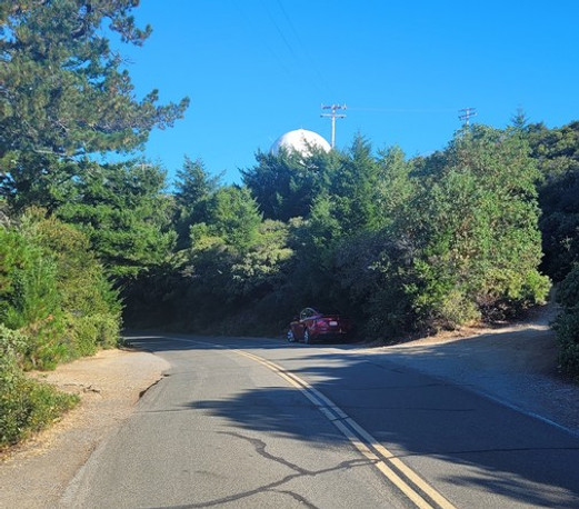
A white radar dish is visible atop the adjacent West Peak. Originally known as Mill Valley Air Force Station and built in 1951, this radar dish was part of a network of posts that were perched atop peaks surrounding the Bay Area. The facility was a USAF general surveillance radar station during the Cold War. These radar sites in the 1950s served as an unbroken warning system against a surprise atomic attack by inbound soviet aircraft prior to the era of intercontinental ballistic missiles. Fighter Jets were kept ready to take off around the clock 10-miles away at nearby Hamilton Field in San Rafael in case the need arose from the early warning system atop Mount Tamalpais detecting inbound hostile aircraft. During the 1950s, there were 28 of these radar stations spread out along the West Coast of the United States until the 1980s. Most of these mountaintop bases were decommissioned as new technologies such as early-warning satellites made the need for these Cold War-era radar sites along the West Coast obsolete.
The FAA currently operates an Air Route Surveillance Radar atop Mount Tamalpais
The Mill Valley Air Force Station stayed active until 1983 when the site was turned over to the park service. The barracks for Air Force personnel atop the peak were finally demolished in 1996, but the foundations remain to this day. The FAA currently operates an Air Route Surveillance Radar at the site, which is what you see atop the peak today. The large white dome atop the west peak collects not only the aircraft position detected by radio waves, but also the altitude or beacon code by sending and receiving signals. The current radar has a range of 290 miles, extending out over the ocean.

Originally built in 1951, Mill Valley Air Force Station operated an early warning radar atop Mount Tamalpais until 1996.
In present day, the FAA operates an Air Route Surveillance Radar at the site, which is what you see atop the peak today.
There are several pullouts along this leg that provide broad expansive views of the San Francisco Bay Area below. During early mornings, coastal fog is ever-present and a clear day is rare although the clarity of your visit is highly dependent on the weather and cyclic time of year. During afternoons, the fog burns off but often a haze remains. Some of the clearest air is often found after winter storms pass over the region inbound from the ocean.
Cushing Memorial Amphitheater, named for the mountain railroad magnate Sidney B. Cushing, isn’t visible or even noticeable from Ridgecrest Blvd, but it’s located a short walking distance from Ridgecrest Blvd and Pantoll Rd main parking lot. Originally built in 1933 as a 4000-seat amphitheater by the Civilian Conservation Corps, the amphitheater was constructed by the CCC using massive blocks of serpentine rock. Mount Tam has been subsequently hosting theatrical performances since 1913 and has hosted the Grateful Dead & Jefferson Airplane along with many other bands. Currently ,the Cushing Memorial Amphitheater is best know for outdoor theatrical plays while producing artistic programming for Broadway-style musicals.

Cushing Memorial Amphitheater was built in 1933 as a 4000-seat amphitheater by the Civilian Conservation Corps
Bolinas Ridge & Ridgecrest Blvd
At 9am each day, the ranger opens up the gate to Bolinas Ridge. My last time through I was at the gate at 8:30 and the gate was open much to my surprise. I was the very first, and only, motorcyclist atop the ridge that day. I had the road entirely to myself.
Ridgecrest Blvd atop Bolinas Ridge rides along the spine of a grassy ridge through the Golden Gate National Recreational Area and is a treasure for Bay Area motorcyclists. This article focuses great detail on the pullouts because, oddly enough, that's the highlight of this ride - the view. The ride end-to-end is a short 5 miles, although you can compensate for the distance by stopping at the pullout of your choice. The small town you are seeing from the ridge along the coast is Stinson Beach, Bolinas and Bolinas Lagoon. This charming coastal town is known for excellent surfing, art, and a tight-knit community. The private enclave used to be known for being difficult to find—thanks to locals pulling down the road signs, so the lore goes.

Not a place to go fast. This road is a actually a place to go slow and enjoy the view.
Hiking trails spider off in every direction from the ridge, including a trail on the east side of the ridge that will connect with Cataract Falls Trail. Much of the western side of the ridge is protected parkland in the Golden Gate National Recreation Area, there is zero commercial development anywhere, and the eastern side of the ridge is watershed lands of the Marin Municipal Water District.

Bolinas and Bolinas Lagoon clearly visible on a day without fog
Ridgecrest Blvd has been featured on many book covers (see above), magazines, and numerous TV commercials. During springtime, these treeless grassy meadows are covered in brilliant green grasses. However, we’ve seen the ridge turn from glowing green to golden brown by Memorial Day during dry seasons. The brilliant green color will peak March through April.
There are several worthy pullouts along the short route, and any pullout along this 5-mile stretch is perfect, however, there are only two pullouts that are paved. Plus, there are so many pullouts that offer spectacular views, you can’t list them all. But let’s try using the Rock Springs Trailhead parking lot as our base.
A mere .4 miles from the start of Ridgecrest Blvd, there is a small gravel parking area on the west side of the road that leads out to Ross’s Roost. The hilltop provides an expansive view southward towards San Francisco and out across the ocean. If you can time your arrival here when there is no marine layer, the views are stunning.

The author's Suzuki TL1000R atop Bolinas Ridge

Pashnit Motorcycle Tours atop Bolinas Ridge
The first of two paved pullouts appears 1 mile from the Cushing Amphitheater parking lot. This tiny area is used by Bay Area Hang gliders who base here and launch a few yards distant.
A few feet away is a narrow pullout on the west side of the road barely big enough for a motorcycle known as the Bolinas Bay Vista. If you are a solo rider, it’s a great place for a quick pic as when you park the bike on the edge of the road, all you see in front of you is space.
This narrow pullout with zero guard rails is the tallest point along Bolinas Ridge at around 2000 ft. That elevation may not seem very high, but considering you’re looking straight down on the ocean below and this vantage point is often above the marine layer hovering atop the ocean surface, it feels like you’re above the clouds.

Take the time to walk up any one of several round top hills along Bolinas Ridge

'Parking for Eight Cars' pullout leads up to a round top with amazing views of the ocean
On the flip side, if the group is large, or there are multiple vehicles in your group, the nearby Laurel Dell Trailhead pullout has more space for parking along with a short trail to a round top, a short walking distance that offers up a tremendous view of Stinson Beach & Bolinas Lagoon below at the ocean level.
At a pullout labeled as ‘Parking for Eight Cars’, there is a view inland looking due north. This viewpoint looks northward across the top of Lake Alpine and across the Coast Range. The hilltop on the west side of the road requires a short uphill walk to another unobstructed 360-degree expansive view of the ocean. This spot is not the highest elevation along Bolinas Ridge, but it’s the tallest hilltop in this section of Bolinas Ridge.

McKennan Gulch Trailhead is one of two paved pullouts along Bolinas Ridge

At the Nip Parking area, the sign labels this as the McKennan Gulch Trailhead, this is the only other pullout along this short stretch that is paved (hang gliding was the first). A short uphill trail leads to the top of the round top hill, then a short descent to a viewpoint of Bolinas. The opposing hilltop on the east side of the McKennan Gulch Trailhead pullout is equally worthy if you’re willing to drudge up to the top of the hill.

McKennan Gulch Trailhead also offers up a round top to walk up to the top of
The McKennan Gulch Trailhead pullout is the last pullout with a stunning view before slipping into the redwood forest ½ mile away. The very last pullout before heading into the redwoods is also the last spot for stunning photography with just the right wiggle in the road as it heads back to the McKennan Gulch Trailhead looking south. If you want great shots of motorcycles on a curvy road, this is your spot.

Bolinas Ridge offers up some of best motorcycle ride shots anywhere
Ridgecrest Blvd narrows as it enters the redwood forest, it also is often covered in detritus from the trees above & often wet from coastal fog. Add a poor condition road and it’s necessary to slow down and coast these last few hundred yards. Pullouts here are often muddy and we’ve ridden this stretch in broad daylight, yet it’s dark, wet, and slippery in the redwood section. Redwood trees produce their own rain by having the coastal fog condense on their leaves and then drip down through the tree canopy to the ground below.
Ridgecrest Blvd ends here and turns into Fairfax-Bolinas Rd. West takes you down the ridge to Highway 1 emerging near Fairfax. Turn east here and the ride flows down a series of switchbacks down to Lake Alpine.

Cataract Falls Trail
Nearing Lake Alpine, when the water comes into view, in the last hairpin will be numerous autos parked on both sides of the hairpin. This is the start of the Cataract Falls Trail, a heavily-trafficked 3.3-mile walking path. Cataract Falls Trail flows up a lush redwood valley alongside Cataract Creek, known for numerous waterfalls during the spring rainy season. Cataract Creek parallels Ridgecrest Blvd, and the southern origin of the creek can be reached from several walking trails on the crest of the ridgeline.


The north end of Bolinas Ridge rides through the redwood forest
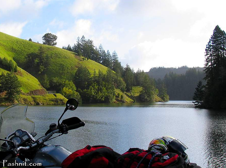
Lake Alpine
Lake Alpine at the base of the hill is a worthy stopping point, especially in spring if water is being released from the dam. Alpine Dam at 147 feet high and one of the oldest dams in the state. Construction on Alpine Dam started in the summer of 1917, but the outbreak of World War I led to shortages of labor and materials for the builder. Completed in 1919, the dam was raised in 1924 and again in 1941 — the structure now has a capacity approaching 3 billion gallons. If you can visit here in spring when the reservoir is releasing water, you’re able to view straight down over the edge of the dam. This water flows into nearby Kent Lake and through Samuel P Taylor State Park before emptying into Tomales Bay.
The ride into Fairfax from the dam is twisty and the pavement is fair. Once you reach the Deer Park Golf Course, the ride descends into Fairfax and there are many more fun backroads to explore in Marin County.
Sir Frances Drake Blvd is the main thoroughfare through Fairfax and leads out to Samuel P Taylor Redwoods. We always avoid this busy stretch of road and ride Nicasio Valley Rd instead to Nicasio. Skip out to Highway 1 at Point Reyes Station past Nicasio Reservoir to reach the ocean, or for more Marin backroads, continue north via Hicks Valley Rd, Wilson Hill Rd to Chileno Valley Rd to pop out at the coast near Tomales.

Early spring water releases at Lake Alpine along Fairfax-Bolinas Rd
Where to Next?
Bolinas Ridge should be the start of your day. It allows you to avoid a congested stretch of Highway 1 from Mill Valley to Bolinas. Explore Marin County with a ride into Fairfax, Nicasio Valley Rd to Point Reyes-Petaluma Rd to Hicks Valley Rd to Wilson Hill to Chileno Valley Rd to reach the coast at Tomales. From Tomales, spend the day along Highway 1, or take an inland route up the Coast Range crisscrossing the range back and forth.
Review the route for our Coast Range Pashnit Motorcycle Tour to spend all day crisscrossing the Coast Range.
Bolinas Ridge
Ridgecrest Blvd Photo Gallery


MORE INFO: Bolinas Ridge - Ridgecrest Blvd
RIDE IT on a PASHNIT TOUR
5 miles, too short - LENGTH
Fairly well-maintained, remote county road - PAVEMENT
10% grade, Endless banked curves with tight hairpins - CURVES
Mill Valley, Sausalito, Fairfax - LODGING
2500 ft- PEAK ELEVATION
GPS LOCATION
37°54′22″N 122°32′42″W - Mil Valley, CA
37°59′14″N 122°35′20″W - Fairfax, CA
NEARBY ROADS:
Fairfax-Bolinas Rd continues the ride
Highway 1
RELATED INFO:
Golden Gate National Parks - Bolinas Ridge

Topo Maps

