South Fork Mountain Summit
Northern California
Horse Ridge Lookout Rd
6.5 miles - LENGTH
One-lane paved fireroad- PAVEMENT
Tight, dirty, potholed - CURVES
South Fork Mountain el 5670 ft - CONNECTS
Dinsmore, Hayfork - GAS

National Forest 23
Quick Ride: Must-do spider road if you have the time.

One of my long-time pet peeves is riding past a road for years on end, and never knowing about it. This problem has gotten better through the years as our available technology has improved. Years ago we didn't have handy planning tools like satellite imaging of roads and Google Street View which I use copiously. Despite all that, twenty years just went by. Twenty! And I've been missing this one road all this time.
But I still love the low-tech hunt. It wasn't until I was conducting a grid square by grid square search of the state using the most detailed paper maps available while planning a ride across Northern California did I stumble on to this short little squiggly line. It was solid denoting it was paved. That's paved? What is that? Pulling up satellite imaging of the road a few seconds later, sure enough, pavement. Never would have guessed. Never would have even noticed it. And to make it worse, this short spur is along one of Northern California's most beloved motorcycle roads.

How many times have we stopped at the top of the South Fork Mountain Summit along Hwy 36? How many times have I ridden right past this little gem? Twenty plus years is the answer, and that's why this website exists. Because if I don't tell you about this, you're going to ride past this for the next twenty years on top of my twenty years and that makes forty cumulative years in the dark. We can't let that happen, now can we?!
Horse Ridge Lookout Road is a paved fire road that extends 6.5 miles south to a open saddle presenting a wondrous view of the Ruth Valley below. Elevation extends to 6000 feet and a recent wildfire has razed an opening into the forest providing an unhindered view that stretches for miles across the ridge lines that make up this wilderness region of Northern California. There is an even higher viewpoint five miles ahead by continuing up NF23 but it's a gravel road from here.


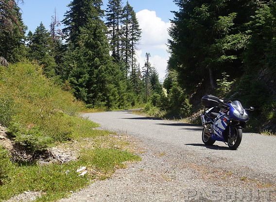
At the South Fork Mountain Summit along Hwy 36, you can find the marked NF 23 on the south side of the road adjacent to the viewpoint. I wonder where this goes? We need that curiosity. The ride is one-lane but considering the remoteness and lack of use, the pavement is in decent shape.
A thin layer of chip seal that's been pounded down is all there is but it's enough to provide a paved road generally cut right up the side of the ridgeline. Halfway up are some wonderful views northward. Seeing the region from this new vantage point makes you truly appreciate local motorcyclist's love for Hwy 36 which is the road you are overlooking from this vantage point.
Curves are gentle for the most point and there are no hairpins or rapid elevation changes (like nearby Lamb Creek Grade at Mad River).

Note this elevation can have snow into late June depending on the winter and locals in their pickups often blaze a path right through the snow drifts. Anything in the afternoon shade will have that stubborn snow that sticks to the mountain top into May or June. It's also worth noting spring snow storms can easily happen when it's raining at lower elevations. If you are up here and a blizzard starts up, just ride off the hill. Makes for a good story later at dinner. We've ridden over this summit in April and gotten snowed on.
There's a special delight in roads like this, short, quick, and knowing a specific destination lies ahead a few miles away. The six miles passes by quickly and the pavement ends at a gravel fork in the road. Left or east takes you back down the mountain to Hwy 36 connecting at Forest Glen. Continuing due south takes you to the aforementioned viewpoint.


Ruth Lake is the valley below to the northwest, sort of behind you when you reach the pavement's end. Man-made, completed in 1962 and well worth a visit, the Ruth Lake loop is made up of Van Duzen Rd & Lower Mad River Rd offering a worthy detour if there are no time constraints and you have an extra hour to loop around the lake via the Hettenshaw Valley.
The best part of this road is riding up to the viewpoint, popping out the kickstand, shutting off the motor and pulling off the helmet. The sound of silence.
Pure silence. Can't get that just anywhere. If you want pure nothing, where all that surrounds is still, you have to come to a place like this. People are willing to pay an indefinite amount for yoga, meditation, retreats all in a bid to gain what you can get right in this very spot.

There are two primitive campgrounds on this ride. Pickett Peak Campground at 5249 feet is near the end just below 5774 ft Pickett Peak and I never even noticed it was there. Near the end of the pavement is also a gravel side road that heads up to a radio tower for an even better view.
Beyond the end of the pavement a mile up the road is Fern Campground, also a primitive campground.
Where the pavement ends, choices are ride the gravel fork that turns left or north or Summer Horne Rd which quickly flows down the mountain to Hwy 36 which I can't vouch for and it resembles little more than a jeep trail. It switchbacks down to Hells Gate Campground just east of Forest Glen and the South Fork Trinity River. A mile ahead is Fern Campground as NF 23 continues up the ridgeline for some stunning views of the surrounding mountains once you reach Horse Ridge Lookout 6072 ft adjacent to Chinquapin Butte.

But if you prefer to stay on pavement this is the end of the line and you'll need to zip back north the 6.5 miles to Hwy 36 to continue your journey. If you are the dual-sport sort, Horse Ridge Lookout does continue as NF23 / Wild Mad Rd and eventually falls off the ridgeline becoming FR2S02 / Wildwood Rd at Barry Creek and drops down to Ruth near the Ruth Airport. It's remote, it's unknown and lord only know why you are wandering around the mountains. But we motorcyclists just like the sound of that.
The unfortunate part about NF23 is the pause in your journey spent on this mountaintop has to end. And you'll need to backtrack to Hwy 36 to the South Fork Mountain summit to continue on your journey.
So, if you've got the time for a spare 13 miles in your hurried journey to get wherever it is you are headed, don't ride past this for the next twenty years like I've been doing. Slow it down, turn off the main road for a few moments and step into a Zen-like moment of stillness where everything stops. If only for a few moments.
Horse Ridge Lookout Rd - Photo Gallery


MORE INFO: Horse Ridge Lookout Road
RIDE IT on a PASHNIT TOUR
6.5 Miles - LENGTH
Poor, Potholed, Dirty - PAVEMENT
Few, Smooth - CURVES
Hwy 36 to Pickett Peak - CONNECTS
Dinsmore, Hayfork - GAS
None - LODGING
5400 Ft- PEAK ELEVATION
Pickett Peak - MOUNTAIN PASS
40°23'45.4"N 123°26'07.0"W - GPS LOCATION
None - LISTED SIDEROADS
Picket Peak, Fern :CAMPGROUNDS
Maps
