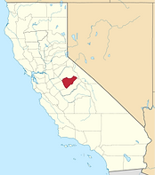
Northern California
Manteca to Benton Hot Springs
Sierra Nevada Mountains
Highway 120

Tioga Pass through Yosemite NP
208 Miles - LENGTH
Excellent, well-maintained, major highway - PAVEMENT
Smooth, tight, endless - CURVES
Hwy 99 Manteca to Benton Hwy 6- CONNECTS
Many - GAS
CLICK FOR MORE INFO
SCROLL to HIGHWAY 120 EAST
Quick Ride: 208 Miles of pure joy, remote, long, scenic, must ride California Motorcycle Road surrounded by even more fantastic roads.
HIGHLIGHTS
Knights Ferry
Old Priest Grade
Wards Ferry Rd
Marshes Flat Rd
Cherry Lake Rd
Hetch Hetchy Reservoir
Tuolumne Grove
Bodie SHP
June Lake Loop
Panum Crater
Mono Mills
Sagehen Summit
Benton Crossing Rd
Chidago Petroglyphs
It’s long, it’s scenic. It flows through the foothills, a national park, and the high desert. And it’s the highest mountain pass in the Sierra Nevada, at a few feet below 10,000. It has a bit of everything, and you must cross it off your list. Oh, and the scenery- so fantasmic, they made it a national park. The only downside? Recent increases in national park fees has the park service asking for ludicrous sums of money to ride over the pass. The park entrance fee is stiff if you’re just out for a leisure ride, but if you are exploring, add it to the cost of your trip.
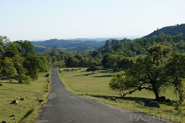
Highway 120 flows eastward, spanning 208 miles from the Central Valley to the Nevada border. One of the longest motorcycle roads in California, it flows across farmland after leaving Manteca at the Hwy 99 freeway on through the tiny towns of Escalon and Oakdale. Our ride joins up with Highway 108 here, another fun mountain pass and easily combined to make a day-loop ride out to Lee Vining and back. The rolling Sierra Foothills begin east of Knights Ferry Covered Bridge.
The present day covered bridge, built in 1863, spans 330 feet across the Stanislaus River and is the longest covered bridge west of the Mississippi. A visitor center and adjacent flour mill foundation are a must-visit, especially on a hot summer’s day. The flour mill was converted to a power plant owned by Stanislaus County, but only the walls remain. Walk across the wooden bridge and take in the construction. The bridge is so well-preserved, it looks like it was built yesterday. The bridge still carried vehicle traffic until 1981. A few feet away is the small town of Knights Ferry, a great stop for ice cream on a summer’s day. There’s also a small museum here, offering up the history of the bridge. Weekends can be busy with rafters as over a 1000 people a day put their rafts in the river here for the float down to Orange Blossom.

Beyond Knights Ferry, Highway 108/120 begins to climb in elevation, but we’re still a main highway here and at the Calaveras County line, the ride opens up into a four-lane highway. Fast pace on up to the Keystone Junction and the turn-off for Highway J59/La Grange Rd, which curls southward around the west side of Don Pedro Reservoir. La Grange Rd is the perfect shortcut south over to Coulterville and the back way to Yosemite’s north entrance (there are three roads leading into Yosemite Valley). La Grange Rd is also the most direct route to Coulterville and Highway 49 The Little Dragon.
You can continue east from Coulterville via Greeley Hill Rd (gas in Greeley Hill) for a more twisty ride over to Highway 120 beyond Groveland and avoid a vast portion of the tourist traffic. It’s longer, but no one knows about this parallel route to Highway 120 to the park border. Lots of options in this region of the Sierra Foothills. Also take note of O’Brynes Ferry Rd / Highway E15 skirting along the shores of Tulloch Reservoir over to Copperopolis.

Old Priest Grade with Hwy 120 in the background
South of Yosemite Junction, Highway 120 splits into a wide 4-lane highway. Cops love to sit in this section of road bordering Don Pedro Reservoir, as the tourist traffic to and from Yosemite naturally speeds up here. There is a broad paved overlook worth the stop along Highway 120 providing a compelling view of Don Pedro Reservoir right before Jacksonville Rd which is the only connecting road to the north. If you are riding westward, Jacksonville Rd is the perfect detour around this straight section of Highway 120 and there won’t be any other traffic on it except a few locals.
Jacksonville Rd doubles back to Jamestown, known for Railtown 1897, an interesting living-history railroad museum. Railtown 1897 itself is a state park site comprised of numerous historic railroad buildings, tracks, turn-of-the-century machinery, modern and historic railroad equipment, and a working turntable. Worth the visit for the train enthusiast. They’ve also shot numerous movies here involving steam trains. Back to the Future & Clint Eastwood’s Pale Rider are favorites.
Jacksonville Rd provides access to Algerine Rd and the Pashnit Tours favorite of Wards Ferry Rd. Once you ride this boring section of Highway120 a few times, you’ll be looking for alternatives. Wards Ferry is a shot in the arm thrill ride, connecting Sonora to Groveland. Picture a steep single lane canyon ride to a famous river crossing, Graffiti Bridge, across the Tuolumne River connecting to Groveland.
Further east, the last paved north-south road is the Cherry Lake Loop from Tuolumne to Highway 120, also worth the ride, this remote mountain loop was carved into the foothills during reservoir building days to reach Cherry Lake Reservoir completed in 1956. The Cherry Lake Loop is a paved road originating from Tuolumne, then flows up and down two canyons and connects back to Highway 120 near the park entrance.

Four penstocks from Hetch Hetchy Reservoir feed into Moccasin Powerhouse
Back on 120 along Don Pedro Lake, you’ll have to contend with the tourist traffic until you reach the river bottom at the Moccasin Powerhouse. Four massive penstocks protrude out of the hillside flowing downhill to the power house built in 1921.

Old Priest Grade goes left, Hwy 120 goes right down Grizzly Gulch
Note a few miles away to the south from the Moccasin Powerhouse at Coulterville is the aforementioned Highway 49 - Little Dragon. There’s another road worth mentioning, 1/2 mile south of the Highway120/49 junction- Marshes Flat Rd (some maps name this as Kelly Grade).
Marshes Flat Rd
Marshes Flat Rd is a single lane paved ranch road. Pavement on Marshes Flat is surprisingly good for a backroad. The mid-section flows across open pasture with grazing cows for companions.
Marshes Flat Road
Marshes Flat Rd (pictured) connects back to Highway 132. Study a map of Marshes Flat Rd beforehand, on the south end, it flows into Blanchard/Granite Springs, a country-residential style neighborhood common to the Sierra foothills. Marshes Flat becomes Blanchard Rd and T-intersects into Granite Springs Rd. A left on Granite Springs and then right on Gusanillo Way will get you back to Highway132 and into Coulterville. Once at Coulterville, ride south on Highway 49 The Little Dragon on over to Mariposa to reach the center canyon entrance into Yosemite Valley. Another option at Coulterville is to continue east on Greeley Hill Rd. All these foothill options are fun motorcycle roads.
Old Priest Grade
At the Moccasin Powerhouse, Highway 120 meets Old Priest Grade. Staying on the main road, Highway 120 steadily climbs up Grizzly Gulch Canyon on the north side. A right turn at the powerhouse will take you up Old Priest Grade, considered one of the steepest roads in the Sierra Nevada Foothills, originally a wagon road up the canyon wall to Priest at the top, passengers in stagecoaches were made to get out and walk to save the horses laboring to pull the stagecoaches up the steep grade. We like to think of Old Priest Grade as one of the steepest roads in California. The elevation climbs from 910 ft to 2450 ft in less than 2 miles, with grade steepness up to 18 percent, and the steepest stretch might be closer to 20 percent.
It’s so steep going up, there’s virtually no place to pull over on a quiet day to get a picture. If you can ride the two miles up with no other traffic, it’s a thrilling ride any motorcyclist will love. Note going down, it’s not uncommon for the smell of burning brakes to linger in the air. Signs warn drivers that trucks, motorhomes, buses and vehicles pulling trailers are prohibited on the Old Priest Grade.
Auto pilots, trucks, RV and any large vehicle should avoid Old Priest Grade and take the northern leg of Highway 120 which is a steady 4.5-mile grade to Priest. There is an occasional place to pass here for the motorcyclist with wide open sight lines, but not on Old Priest Grade.

View from Old Priest Grade Cabins of Old Priest Grade and Hwy 120
Want to see Old Priest Grade, Click on this video: Drift Trike Mafia.
Priest Station at the top of the hill holds a small coffee shack/restaurant and the Old Priest Station Motel (pictured above), offering small 1940s motel rooms to rent overlooking the canyon known as Grizzly Gulch. We have used Old Priest Station as a planned lunch stop with outdoor seating overlooking the canyon. At the top of the hill, note Priest Coulterville Rd heads south and, as the name implies, connects Priest to Coulterville. It’s a two-lane foothill ride over a low rise to Greeley Hill Road. Connect with Smith Flat Rd to make a worthy detour back to Highway120 and avoid all the tourist traffic through Groveland. Also note the southern entrance to the Cherry Lake Road loop (west of Harden Flat) if you prefer to circle round to Tuolumne (& Sonora) via Cottonwood Rd.

Pashnit Tour group at Graffiti Bridge on Wards Ferry Rd
Wards Ferry Rd
Beyond Priest are some congested miles through Big Oak Flat and then to Groveland. Note Big Oak Flat is the southern entrance to Wards Ferry Rd on over Graffiti Bridge back to Tuolumne and Highway 108 Sonora Pass. Wards Ferry is a narrow one-lane canyon ride down to the river and back. Super fun backroad everyone must ride!
Nearby Groveland was once the home of 22 short-lived saw mills after WWII. At Groveland is a fun detour to keep you off the main highway known as Ferretti Rd looping around Pine Mountain Lake, a gated retirement community built in the late 1960s. Ferretti is longer and is not a shortcut, it adds miles, but twisty miles. If you are in a hurry, stick to Highway 120. It's main (straight) highway here, recently repaved, and fast.

Wards Ferry Rd is a single-lane-paved canyon ride
Cherry Lake Rd
After passing by Cherry Lake Rd, there is the back way over to Hetch Hetchy Reservoir on Mather Rd (FR 12) accessed from Cherry Lake Rd. The far eastern half of the loop is a fun ride and worth the detour.
Note the main turnoff for Hetch Hetchy Reservoir, designated Evergreen Rd, right before the park boundary, is interesting and rather scenic especially in Spring when the waterfalls are flowing.
Hetch Hetchy Reservoir
It’s 7 miles to the guard shack outside Mather. About 30 minutes away, the ride to Hetch Hetchy is single-lane goat at times, but it's worth the hour-long detour to go check out the massive O'Shaughnessy Dam built to store the water supply for the city of San Francisco on the other side of the state and continues to be the subject of controversy to this day. Some think O'Shaughnessy Dam should not have been created. The argument is the O'Shaughnessy Dam flooded one of the most scenic valleys in the Sierra Nevada Range.

Hetch Hetchy Reservoir is the water supply the City of San Francisco

Black Bear at Crane Flat
Then you’ll hit the Yosemite park entrance 30 miles east of Groveland. It costs $30 as a motorcyclist to enter the park. Note military veterans get into any national park in the United States as of November 2020 for free (entrance fee only) along with Gold Star Families. Carry your military ID while Gold Star Families require a voucher downloaded from the NPS website.
In 2018, Yosemite NP raised the fees even more to $35 per car. For perspective, it used to be $10 a few years ago. We’re not sure where the tripling of entrance fees is going. 4.1M people visiting Yosemite each year works out to $123M in cash per year, or $10M every month.
What are they doing with $123 million dollars? We’ll never know. The park responds it’s for maintenance and upgrades. $10M in upgrades every month? Again, where’s the money going? Do you notice $10M in improvements every month passing by. By 2027, Yosemite NP will have taken in $1 billion dollars (with a B) from the increased park entrance fees. It’s a 200-mile ride, your mind wanders.
With your motorcycle, the pass is good for 7 days. If you plan on visiting more than twice in a year, buy the yearly pass which is $70. Remember to save your receipt, you'll need to show it when you leave the park.
There is gas right before you enter the park boundary at Hardin Flat. Several miles east of the park entrance at Crane Flat, Highway 120/Tioga Pass splits.
To reach Yosemite Valley, follow the train of cars east on Big Oak Flat Rd into the valley. Recent changes in the 7-mile one-way loop have made the ride to the Ahwahnee Hotel for lunch painfully slow. What used to be two lanes has been changed to a single lane for traffic and the other lane for bus & park vehicles only. Do the math, it’s 4.1M people on a one-way one-lane road. The only solution is do your movement early in the morning, find a place to park, then stay there. Don’t come here on any sort of holiday and if you can, only ride into the valley on off-days. We used to ride easily in and out of the valley, and offered three Pashnit Motorcycle Tours a year into the valley, but now the road is one-way one-lane, the congestion it creates can be pure madness.
Tioga Pass truly begins at Crane Flat, which is where the black bear above was photographed. A few feet away from all the tourists filling up their automobiles with gasoline. While the gawkers all snapped pics (including our motorcycle tour group), a nearby park ranger kept a watchful eye and answered any questions about the black bear. A few feet away was another bear napping in a tree.
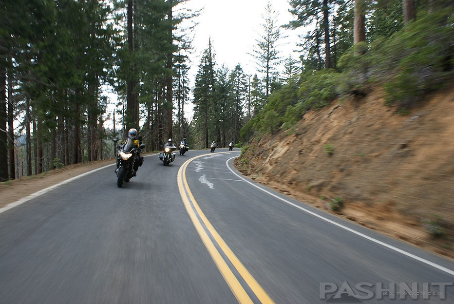
Tioga Pass is scenic, but predictably slow-going as you ride across the Sierra Range. Allow some time, load up a good dosage of patience for the tourist traffic, and just ride. There’s almost nowhere to safely pass. If you get stuck behind a long train of cars, just pull over and take a break. It’s the only way to not lose your lunch at the tourist traffic lumbering over the pass which can be thick leaving Crane Flat and thinning out as you near Olmsted Point.
Tuolumne Grove
A short distance away from Crane Flat is the Tuolumne Sequoia Grove. There’s parking for your bike, and a walking path flows to one of three groves of giant sequoia trees. (Mariposa Grove is also found at the south entrance to the park on Highway 41). These massive trees will inspire and generate a sense of awe each time you see them.
This sequoia grove is reached via a 2-mile round trip on footpaths covering a 600-foot elevation change. If you are unable to invest that much time, make a point to visit Calaveras Big Trees SP along Highway 4 Ebbetts Pass near Arnold which has giant sequoias right beside the highway. Calaveras Big Trees SP even has a tree stump so large it was used as a dance floor in the late 1800s.

Where's the curves? Where’s the vistas? Not so fast. Highway 120 on the western half of the Tioga Pass lazily climbs in elevation, meandering through pine forests. As much as they mention how scenic of a drive it is, this first portion may have you wondering if you picked up the wrong brochure. Add in the lumbering tourist traffic, who have a tendency to seem lost, a bit of patience may be in order. Recent wildfires in the park have burned both sides of the road at the western end of Highway 120 near Crane Flat, but the forest recovers quickly, and you may not even notice a burn scar except on tree trunks.
Climb! Up the hill along Mount Hoffman, el. 10850 you go. Not a lot happens until you near Olmsted Point. There are several viewpoints along the way, but you'll finally believe all the hype you've read about Tioga Pass once you reach Olmsted Point- likely the most popular overlook along the way. The majority of the scenic stops are on the eastern half of the ride.
Finally reaching Olmsted Point, Half Dome is clearly visible and a newly improved walking path from the parking area down steps of solid granite blocks leads out to the stunning unobstructed view pictured below.
Olmsted Point
This turnout was named in honor of famed landscape architect, Frederick Law Olmsted (1822-1903), and his son, Frederick, Jr., when Tioga Road was opened to automobile traffic in 1961. Olmsted Senior was considered the father of American landscape architecture, and best known for his design of New York's Central Park. He was chairman of the first commission to manage Yosemite Valley and the Mariposa Grove, and wrote a report recommending policy for the care and protection of Yosemite's scenery and wildlife. It is considered a classic national park treatise.
Frederick Law Olmsted Jr. (1870-1957) also worked in the field of landscape architecture. He collaborated with the National Park Service and was a member of the Yosemite Advisory Board, a group of experts who helped park managers solve problems. He maintained a lifelong commitment to conservation, contributing the guiding language in legislation establishing the National Park Service in 1916.

Half Dome as seen from Olmsted Point along Hwy 120 Tioga Pass

Peter indicates the location of the tour group at Olmsted Point: The shiny rock is Half Dome.
There are plenty of motorcyclists up here at the viewpoint for Half Dome. And it's a good chance to swap the "Where are you from?" question.
Whether the answer is local, or a group from some European country, Olmsted Point is a great meeting spot for motorcyclists and the half-way point along Tioga Pass. Even when it may be just you, the proverbial comment of, "nice bike, I used to ride..." may lead into an entire conversation about days of yore. Even non-motorcyclists will want to chat about your ride. Sloping granite rocks allow for wandering above and below the point. During June, when the pass is first opened, there will still be plenty of snow on the ground to play in.
Leaving Olmsted Point and making eastward, the ultra-scenic portion of Tioga Pass begins in force. A short distance later is Tenaya Lake, which unmistakably has to be one of the most beautiful alpine lakes in the Sierra Nevada range.
Tenaya Lake
Tenaya Lake with its ultra-clear water is framed by monolithic granite domes, and sits at an elevation of 8150 feet. The natural lake was formed by glaciers carving this valley ringed by granite slopes. Several creeks and springs feed into Tenaya Lake, which then empties into Yosemite Valley and into the Central Valley. The Tuolumne Ice Sheet created Half Dome and created this lake. Highway120 runs right along the edge of the lake. It's an opportunity to pause the journey for a moment, take your riding boots off and cool down on a summer’s day.

Tenaya Lake
Tuolumne Meadows
A few bends later, Tuolumne Meadows arrives. This large oval shaped alpine meadow contains the deepest and brightest greens. Color is alive here and the meadow, much like Tenaya Lake, is framed by snow capped mountain domes of granite.
There are walking paths encircling the meadow, so if you brought some walking shoes and have the time, take a stroll! Campgrounds abound, so be on the lookout for people-traffic.
It’s not uncommon for people to reserve campsites up to a year in advance in Yosemite NP. On the far east end of Tuolumne Meadow is a small general store, and a great stop for ice cream.

Tuolumne Meadows along Tioga Pass - In mid-June

Tuolumne Meadows, at 8,600 feet, is the largest subalpine meadow in the Sierra. Long the focal point of summer activity, it is growing in popularity as a winter mountaineering area.
Tuolumne Meadows is a favorite starting point for backpacking trips and day hikes. The meadows are spectacular in early summer, abounding in wildflowers and wildlife.
This section of Yosemite has some of the most rugged, sublime scenery in the Sierra. In summer the meadows, lakes, and exposed granite slopes teem with life. Because of the short growing season, the plants and animals take maximum advantage of the warm days to grow, reproduce, and store food for the winter ahead.
Tioga Pass at 9945 feet is the highest automobile pass in California. The first part was a wagon road, 56 miles long, going from Crane Flat on the west side to the silver mine on the east slope of the Sierra Nevada. It was constructed in 1883 at a cost of $61,000. This first part terminated a short distance east of Tioga Pass. The mine was closed the following year as it was not profitable.
Construction of the second half from Lee Vining on the east side to Tioga Pass was begun in 1902 and was completed in 1910 at a cost of $63,000. Considered a monument to the skill of state road engineers, it was routed up Lee Vining Canyon and had a maximum grade of 7%. It was a narrow, exciting road at one time with a steep drop off to Lee Vining Creek below.

Highway 120 - Tioga Pass in June
The original wagon road from Tioga Pass to Crane Flat, now a seldom used toll road, was purchased by the director of the National Park Service, Stephen Mather in 1915 for $15,000. He donated it to Yosemite National Park. The Tioga Pass Road was now complete and automobiles started using it in 1915.
As automobile traffic on the road increased, the need for improvements also increased. Because it was an all dirt road until 1937, maintenance costs were very high. After extensive study, the road within Yosemite Park was completely rebuilt in 1961 at a cost of $7,000,000. The Lee Vining grade east of Tioga Pass and outside Yosemite was rebuilt from 1965 to 1970 at a cost of $6,600,000.
The Tioga Pass Road today is the most scenic mountain road in all of California, and one of the most beautiful park roads in the entire park National park system. -American Society of Civil Engineers

Blowing snow and high winds over Tioga Pass - in June
Highway 120 often gets so much snow, it may not open till mid-June. Yosemite NP loves to post up snow plow pics in May and post up the progress on their website. You can also look up open/close dates on-line. 2010, 2019 & 2024 were especially heavy snowfall years, not opening till June 21 in 2019. In 2020, the pass opened on June 15. Snow pack of 10 feet and drifts as high as 15 feet can be common at nearly 10,000 feet in elevation.
We’ve led some motorcycle tour groups through Highway 120 on opening day in mid-June, and water flowed across the road in numerous spots from adjacent snow melt. 10 feet of snow still lined the side of the road in mid-June.
It's worth noting it can snow any time of the year at 10,000 feet. Riders on Pashnit Tours have been surprised when riding over the pass, and we encountered snow flurries with 32-degree temperatures. There is no sympathy from your fellow riders. You should know better. At 10,000 feet, anything is possible, and you should layer accordingly like mom made you as a kid.

Ellery Lake
East of Tuolumne Meadows is when the road kicks into gear and continues the scenic parade. The park entrance is also the highest point on the road at 9945 feet. Depending on the mood of the rangers, they may check to see if you paid the entrance fee. The many Pashnit Motorcycle Tour groups I have led through here, they often wave us past. Ellery Lake was named after the State Engineer that built Tioga Road east of the Guard Shack. The lake requires a quick stop for another photo. Ellery Lake at 9462 ft. is a man-made lake, and also has the usual USFS campground on its shores with 12 sites.
The original pre-1920s road is still under the lake and occasional drops in the lake level expose the original one-lane road, including a 100-year-old one-lane wooden bridge preserved in the cold water. Tioga Peak to the north overlooking the lake tops out above 11,000 feet, while nearby Mount Dana rises to 13,000 feet. There is no walking trail around the lake, but several viewpoints provide stunning views. Below the lake are a series of waterfalls as the creek plunges down Lee Vining canyon, flowing into Mono Lake. The largest is viewable from Highway 120.

9462 foot Ellery Lake

Highway 120 alongside 9462 foot Ellery Lake

Highway 120 along 9462 foot Ellery Lake
Riding Lee Vining Canyon is the icing on the cake for the eastbound ride over Tioga Pass, and there are several pullouts where one can pause the ride to take a moment. Highway 120 looks to be cut right into the side of a collapsing mountain side. But since it’s been there since 1970, we'll have to assume the road won't be sliding off into the canyon anytime soon.

Pashnit Tour group on Highway 120 descending into Lee Vining Canyon
Sightlines are good here, and it may be a brisk ride to the bottom. A motorcycle buddy often likes to regale his golden days of yore hitting 70 mph, on his bicycle, and passing cars all the way down on this stretch. If you approach from the Nevada Highway 395 side, instant rewards as the road hits the back entrance of the park climbing some 3000 ft in about 10 miles up to the 9945 ft entrance.

Lee Vining Canyon on Hwy 120 Tioga Pass drops down to Hwy 395
Lee Vining
Once you hit the intersection with Highway 395, there's the Whoa Nellie Deli on the south side of the road with a Mobil station for gas. Circle north to Highway 108 or Highway 89 to Highway 4 if you want to make a loop. Even if you don't need gas, you should turn here anyway and ride the short distance to an easily missed viewpoint overlooked by a large flagpole flying an American Flag. Here one can see an eye-stretching panorama of Mono Lake stretching the full 180 degrees. Visible in the middle of Mono Lake is Paoha Island. Black Point, Negit Island, and Paoha Island are of volcanic origin. Paoha Island emerged within the last 350 years.
You hear so much about Mono Lake because its salinity is three times greater than the ocean. If you see Save Mono Lake bumper stickers in the area, it's because the water level has dropped as much as 46 feet, to half of its original level. Mono Lake's entire ecosystem was slowly being destroyed to provide water for the Los Angeles basin. In turn, Mono Lake became the poster child for water activists across the nation. Mono Lake is on the way to restoration though, and you can visit the Visitor Center north of Lee Vining, or visit the south shore via the eastern leg of Highway 120. Strangest of all, are the millions of alkali flies coating the shore black. Worth the detour.

Vista Point of Mono Lake at the Whoa Nellie Deli in Lee Vining, CA

Sunrise over Mono Lake Tufa
Bodie State Historic Park, one of the best-preserved ghost towns in the west, is 31 miles north from Lee Vining. This unique park offers a curious glimpse of 1880s mining camp life. Unimproved, unrestored and in a state of suspended animation, Bodie SHP is accessible via Bodie Rd/Hwy 270 from Highway 395, only the last 3 miles (of 11) are washboard gravel, but passable on any type of motorcycle. For the history buffs, it shouldn't be missed. Note the elevation of Bodie is 8379 feet, so the town is only reachable in summer months. Cottonwood Canyon connects south out of Bodie as a dirt road for the dual sports and jeepers back to Highway 167.
Winters on this mountain top were especially harsh in the late 1800s, when Bodie gold mines produced over $100 million dollars of gold via hard rock mining. Historical records showed snow up to the eaves of buildings and white-out storms so blinding on this remote high-desert 8000-foot mountain top, inhabitants got disorientated walking across the streets of the town, became lost and froze to death in the blinding snow.

Highway 120 East
To continue east on Highway 120, hop on Highway 395 (top off gas) and ride a few miles south to the Highway 120 junction. Note cops love this section of road between Lee Vining and 120 as the speed drops as you near the town riding northbound, and you may see CHP south of Lee Vining.
The June Lake Loop is a 16-mile loop to the edge of the Minarets Wilderness. June Lake is known as the Switzerland of California. It shouldn’t be missed if you have the time. Highway 158 is a short trek back to Silver Lake into the small community of June Lake. Known for camping in summer and skiing in winter, it’s a quick in-and-back and wonderfully scenic.
During fall, the aspen trees change color to brilliant yellows. Worth mentioning is detour off Highway 158 onto Northshore Rd and ride around the north side of June Lake. High desert views and if the time of year is right, snow capped peaks line the view. There are several small mom-and-pop lodging establishments, but no Holiday Inns or Best Westerns have discovered this tiny ski town yet. There’s a small Shell gas station at June Lake Junction. Be sure to be fully gassed up before heading out east into the desert.

June Lake Loop - Highway 158 is a must ride
Panum Crater
Panum Crater is reached via a one-mile dirt road from Highway 120. The access road is located 3-miles east of Highway 395 and only marked with a small sign for Panum Crater & an arrow. There's a small dirt parking lot near the crater wall. Panum Crater is a volcanic cone part of the chain of craters along Highway 395. Panum Crater is very recent in geologic history at between 600 and 700 years old. Panum Crater is the youngest crater of the series of Mono Craters along Highway 395, also making it the youngest mountain range in North America. The cone exhibits all the classic characteristics of a textbook rhyolitic dome.
From the parking area, there is a dirt path to the crest of the cone. A hiking trail extends around the rim of the cone, and another extends to the center of the plug dome at the center of the crater. Note the elevation here is 6500 ft and you'll feel the lack of oxygen if you're not used to it. Despite the elevation, the region can be rather hot during California summers.

Panum Crater is near the Highway 120 & Highway 395 junction,
Highway 120 is the road at top
The eastern leg of Highway 120 to the Nevada border skirts the northern edge of the Inyo National Forest and is another remote high-desert road any rider is guaranteed to love. You can combine Hwy 120 with Benton Crossing Rd to create a 68-mile remote loop back to Highway 395. We’ve ridden Benton Crossing Rd numerous times and not seen a single car in 50 miles.
Highway 120 changes flavor from a mountain pass to a remote stretch of high desert road along the south shore of Mono Lake. Highway 120 along Mono Lake is a personal favorite having led many Pashnit Motorcycle Tours along this section whenever we are in the area.
There are several fast corners in this 5-mile stretch to the Mono Lake turnoff. The pavement for Highway 120 is perfectly smooth and the sagebrush in springtime emits a pleasingly smooth aroma. Sagebrush gives off a powerful, pungent fragrance because of the presence of camphor, terpenoids and other volatile oils.
Mono Lake
Take the detour off the main highway to the south edge of Mono Lake. The 1-mile distance to the South Tufa & Navy Beach parking area is washboard gravel, but the parking area is rarely congested the many times our motorcycle tour groups have swung by. The road splits and the right leg leads to Navy Beach parking area, slightly closer to the lake and a favorite parking spot for putting in kayaks. South Tufa parking area offers a boardwalk path down among tufa towers to the water’s edge.

Test Station Rd leads to the parking area along the south shore of Mono Lake
A Fading Oasis
In 1941 the City of Los Angeles extended its aqueduct system into the Mono Basin, diverting water from four of the six mountain streams that feed Mono Lake. Without freshwater from the streams, the lake lost more to evaporation that it gained from inflow. Mono Lake dropped nearly fifty vertical feet, shrank to half of its volume, and doubled in salinity over the next forty years. Miles of newly exposed lake bottom created unhealthy and unsightly dust storms in the windy basin. These drastic changes affected the health of the lake ecosystem, impacting local wildlife and fisheries, migratory birds, and human health.
The Struggle for Solutions
In 1978 a coalition of citizen's groups led by the Mono Lake Committee began to look for solutions to save Mono Lake. Recognizing the scenic and biological values of the lake, they called into question the legality of the city's water diversions. Then in 1983 the State Courts ruled that the Public Trust Doctrine (protecting navigable bodies of water for all citizens) applied to Mono Lake. According to this law, "the human and environmental uses of Mono Lake...deserve to be taken into account. Such uses should not be destroyed because the state mistakenly thought itself powerless to protect them." California Supreme Court, 1983
In 1990 the court ordered that the LA Department of Water and Power's activities must comply with Fish and Game Code laws to protect fisheries in the creeks below the diversion points. To re-evaluate the City's water license, the State Water Resource Control Board collected data and testimony from scientists, citizens, organizations, and agencies. With this information, they then prepared a management plan for Mono Lake.
On September 28, 1994, ten years to the day after Mono Basin was designated as a National Forest Scenic Area, the Board decided that the lake must be raised to an elevation of 6392 feet, which may take 20 years. This is 19 feet higher than in 1994, but 25 feet lower than when diversions began in 1941. All parties agreed to accept the plan and move forward in a spirit of cooperation outside the courts.

The 2012–2016 California drought lowered the lake 7 feet. The lake level then rose 4.5 feet in 2017, and the lake level held steady in 2018. The 2018 runoff year was classified as Normal, and Mono Lake rose to 6381.9 feet above sea level by March 1, 2019, April 1 is the start of the 2019–2020 runoff year; DWP’s runoff forecast on March 1 was 142% of average. The lake reached 6381 feet in 2020 within 10 feet of the proposed target.
The lake level before the diversions of Mono's tributary streams was 6417 feet above sea level. In 1982, Mono Lake reached its lowest recorded level of lowest recorded elevation of 6372 which exposed 17,300 acres of barren shoreline. The goal is to have the lake reach 6391 feet. (In 1951, the lake level sat at 6410 ft.) Once that occurs, a new set of restrictions apply to water diversions. No diversions will be allowed if the lake drops below 6388 ft.

Dip your fingers in the water of Mono Lake and note it feels soapy. The salt creates an elevated buoyancy. You can swim in Mono Lake, and it’s also a favorite of kayaks to gently float along the shore. Mono Lake has no natural outlet, water only leaves via evaporation. The yearly evaporation rate is approximately 45 inches per year, rising up and down nearly 4 feet. While there are no fish, and you might assume it is a dead lake, conversely Mono Lake is considered one of the most productive ecosystems in the world.
The high salinity has created an ecosystem based on brine shrimp thriving in the alkaline waters. The brine shrimp in turn provide sustenance for migratory birds including 50,000 California Gulls, another 4M migratory birds, and billions of alkali flies. Tufa Towers (pronounced too-fa) line the walkway to the lake shore and protrude up from the water’s edge, unlike anything you may have seen.
Calcium-rich water bubbling up from underwater springs combine with carbonate-rich water in a chemical reaction, creating the lime-based structures. Tufa towers are easily viewed on the southern shore, and also the western shore north of Lee Vining. The towers can reach a height of 30 feet. The tufa towers were at one time all underwater, but are visible today due to the dramatic drop in the lake level. The western shore holds a recently built visitor center if you’d like to learn more about the lake.
If it’s the correct season, the shoreline is black and moving. Walk through this color black and a cloud of alkali flies erupt from the ground. They fly up unconcerned with you and settle back to the shore line more interested in consuming the algae. They line the shoreline and also float on the water. The alkali flies lay their eggs underwater and the larvae hatch, then develop underwater, eventually emerging and walking along the shoreline. The abundance of flies creates an ecosystem feeding off these flies. California Gulls are plentiful, feeding off the flies. Native Americans in the region also consumed the alkali flies as part of their diet.
Navy Beach
During the Cold War, Mono County was home to many remote facilities used by the US Military to test new weapons and weapon systems. A “secret military installation” operated by the US Navy was located on the south shoreline of Mono Lake.
During the 1950s and 1960s, several branches of the US armed forces utilized this test facility to conduct various research. Numerous top-secret exercises were actually performed here during what was called “seismic testing.” However, with the expansion of the other nearby bases, growing public safety and environmental concerns, this facility soon outgrew its usefulness. In May 1962 all operations were ceased and soon thereafter the facility was abandoned.
Although many scientists, technicians, soldiers and sailors worked at this installation for many years, all that remains today of their activities are a few remnants and the name “Navy Beach.”


The shore is black, and moving. Billions of Alkali Flies feed off algae along the lakeshore.
The United States Navy carried out a series of underwater explosion tests during the Cold War. The plaque at the site describes these explosions as top-secret seismic tests. There’s nary a hint of the military establishment any longer, but the most fascinating thing about the path to Mono Lake are the occasional signs denoting the water levels from several decades ago.
Mono Mills
One mile east of the entrance to Mono Lake is a parking area for the ghost town of Mono Mills along with some picnic tables and interpretive signs. This lumber camp logged the forest in the hills to the south of Highway 120 and brought them here to be milled to supply the Bodie gold mines. Bodie is located due north on the other side of the lake at an elevation of 8379 feet.
The Mono Mill site originally built in 1880 is nothing more than a couple of old logs denoting the foundation of the saw mill. A railroad was completed in 1881 between this site at Mono Mills and Bodie. Firewood and logs were brought in to the gold mine to provide building materials for the mine and the town.
During its peak, Mono Mills produced 45,000 cords of wood pulled from the Inyo National Forest to the south of the mill site. Trees from the virgin forest were primarily of Jeffery Pine, with lodgepole pine at about 8,500 feet and above. The trees were cut into cord wood and finished lumber, then loaded on railcars. Today, the railroad bed is barely perceptible.

Near Mono Mills
To meet the ever-increasing demand for lumber and cord wood, the Bodie Railway and Lumber Company was formed in February 1881. Timber was harvested from various tracts to the south. It was milled at this site and then shipped to Bodie on the railroad via Warm Springs and Lime Kiln. The sawmill was a two-story structure capable of producing 80,000 board feet in a 10-hour shift (when the crew was sober) and was powered by a 16-inch steam engine. With the development of electricity at Green Creek and reduced gold production in Bodie, Aurora and Masonic the demand for lumber and fuel wood diminished, and Mono Mills was abandoned in 1917.
The Mono Mill site has all but vanished into the sandy soil, but it’s still worth the stop to read the interpretive signs and view the pictures of the old locomotives. The railroad tracks were eventually pulled up when boom turned to bust in Bodie and were sold to the Philippines while the steam locomotives were transported piece by piece all the way to Hawaii for use on a plantation there.
Mono Craters
South of the mill site are Mono Craters which are not visible from Hwy 120. The Mono-Inyo Craters are only accessible via dirt roads and are a 10.5-mile chain of at least 27 volcanic domes. This volcanic chain of craters, domes and lava flows lie to the south of Hwy 120 and border Hwy 395.

The Mono Craters are a chain of volcanic mountains. The highest stands 2700 feet above the valley floor. When they began to form late in the ice age, this basin was covered by Ancient Lake Russel. Mono Lake is a remnant of that lake. Initially in their formation, a series of explosions created high, bowl-shaped cones of pumice (volcanic froth). Later, great domes of obsidian (volcanic glass) arose in the cones. The obsidian usually overflowed the pumice rims and advanced onto the plains as steep-sided jumbles of boulders. These obsidian domes and flows are dominant features of the craters. Pumice, blasted out and carried by the winds, covers many square miles of ancient lake sediments and glacial debris to a depth of several feet.

8139 ft Sagehen Summit
Sagehen Summit
East of Mono Mills and Mono Craters, the ride flows over 8139 ft Sagehen Summit. This ridgeline is barely perceptible but for a large dirt parking area on the summit, which often has fun-mover RVs parked and a side-by-side UTV at the ready to explore the many dirt trails. Dual sports will also be re-joining the road here or setting off into the nearby hills for a trek up to the nearby 9172 ft Crater Peak.
While these photos may look like desert landscapes, 8000 ft elevations make them high-desert and subject to extreme and sudden changes in weather. High winds and snow can be common in winter, and surrounding peaks will be adorned in snow well into June. The road could be closed at any time due to extreme weather. Scroll down and view the weather app for Lee Vining below. Again, layer up like mom taught you.

Black Lake along Highway 120 nearing Benton
Highway 120 enters a long, sweeping hairpin as it drops off Sagehen Summit and into a high desert run bordering the nearby Nevada border. There are several whoops here that are 3rd grade fun. You can find these at few places in the state. Highway 58 is also famous for whoops. At the right speed, your heart drops into your toes, and you’ll feel like you are floating for a fraction of a second.
You’ll emit an audible squeal of delight, I promise.

West of Benton, Highway 120 offers up super fun whoops across the Adobe Valley
We revel in the chance to ride a section of road, reminding of how life was before road straightening was invented. Road builders didn’t plow through these rolling hills, they took easy street and paved over the top of them. Alluring dirt trails lead both south and north, calling out a siren song for the dual sports and the side-by-sides. We’ll stick to the pavement, along Black Lake and the Trafton Mountain Range.

208 Miles later near the eastern terminus of Highway 120
Benton Crossing Rd
Highway 120 mates up with a T-intersection for Benton Crossing Rd 38 miles after leaving Highway 395. To complete the loop, turn south onto Benton Crossing Rd, circle around the Glass Mountain Ridge and return to Highway 395. This is the perfect detour for those headed north or south along the Highway 395 corridor and not in a hurry to be anywhere. Riding this loop back to Highway 395 places you 2 miles from Crowley Lake Rd - Lower Rock Creek Rd, a detour known as a shunpike allowing you to ride parallel to the main highway.
Eastward over the hill is Benton Hot Springs, est. 1852. There’s a collection of buildings centered around the historic Inn at Benton Hot Springs, originally built in 1904. Today, a historic inn offers seven rooms and a soak in 140-degree hot spring baths. Nearby is Benton and the intersection with Highway 6. There is a gas station at the intersection with Highway 6. Bishop is 34 miles to the south, Tonopah 81 miles to the east. Beyond is wide open Nevada.
Chidago Petroglyphs
Seventeen miles south of Benton from the eastern terminus of Highway 120 are the Chidago Petroglyphs. If you've ridden this far on Highway 120 across the open high desert, this region has several petroglyph sites that are sprinkled across the high desert region north of Bishop. All of them require treks on dirt roads to reach. The Petroglyphs are estimated at 1000-10,000 years in age, but no one really knows who carved the glyphs into numerous rock walls or what they mean. Seventeen miles due south of Benton is Petroglyph Rd. The pavement ends and Petroglyph Rd extends west as a narrow gravel road .7 miles to a small parking area. On the rock face that borders the nearby dry wash are numerous carvings into the wall. Fascinating stuff, and well-worth the journey. There are even more petroglyphs to the south following the same gravel road if you'd like to see even more.


The dirt road to the Chidago Petrogyphs is .7 miles to the dry wash in the distance where the petroglyphs are located- well worth the detour.
Estimated at 1000-10,000 years of age, no one knows what these glyphs mean or who put them here.

Combine the Benton-Crossing Loop with Highway 120
Closing Thoughts
This write-up covers the full 208-mile length of Highway 120, but you're more likely to ride it in segments. The western stretch headed into the Sierra through Old Priest and Groveland. Planned tours and trips often only focus on the main road, but take note of all the alternative roads mentioned below, especially around Groveland and Hardin Flat. And the often passed over the eastern section of Hwy 120 over Sagehen Summit. We love all of it and there are several flavors to choose. Integrate a section into your ride, and don't miss checking out Mono Lake and walking along the shore of this unusual body of water. Traveling north or south along Highway 395, it's easy to add the Highway 120 - Benton Crossing Loop and the June Lake Loop into your ride to spice things up.
Highway 120 - Bonus Photo Gallery


MORE INFO:
Highway 120
208 Miles - Manteca to Benton - FULL LENGTH
Major highway, well-maintained, excellent - PAVEMENT
Endless, smooth, tight sections at Priest - CURVES
Manteca to Yosemite to Nevada border - CONNECTS
Manteca, Groveland, Crane Flat, Lee Vining, Benton - GAS
Groveland, Lee Vining, Benton - LODGING
9945ft - PEAK ELEVATION
Endless Road, Yosemite National Park, Mono Lake - HIGHLIGHTS
LISTED CONNECTING SIDEROADS:
Hwy J59/La Grange Rd
Greeley Hill Rd
Highway 49 - The Little Dragon
Hwy E15 / Ocoun’Brynes Ferry Rd
Jacksonville Rd
Algerine Rd
Wards Ferry Rd
Ferretti Rd
Cherry Lake Loop
Marshes Flat Rd
Hwy 49 The Little Dragon
Old Priest Grade
Priest Coulterville Rd
Smith Flat Rd
Cherry Lake Rd - Cottonwood Rd
Mather Rd (FR 12)
Evergreen Rd
Bodie State Historic Park
June Lake Loop
Benton-Crossing Rd
Nearby Sierra Nevada Mountain Passes
Highway 108 - Sonora Pass
Highway 4 - Ebbetts Pass
Highway 89 - Monitor Pass

Maps
Tell fellow riders about your ride on Highway 120

