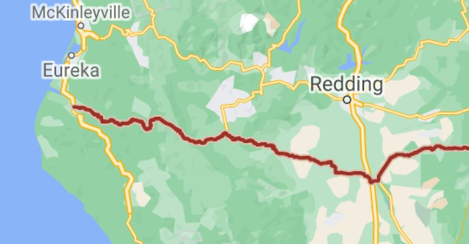
Red Bluff to Fortuna

Northern California
Highway 36

Quick Ride: Longest twisty road in the state, loved by all, generally considered the Best Motorcycle Road in California and possibly the West Coast. Nearly 2000 corners in 140 miles. (yes, someone counted)
Bucket-list motorcycle ride. 5000 ft pass in the center.
140 Miles - LENGTH
Dreamy- PAVEMENT
1811 of them, Tight, Many, Switchbacks - CURVES
Red Bluff to Fortuna - CONNECTS
Dibble Creek, Dinsmore, Hydesvillle- GAS

HIGHLIGHTS (east to west)
Dibble Creek Outpost
Platina Rd
Wildwood Rd
Natural Bridge
Highway 3 - Hayfork Pass
Horse Ridge Lookout Rd
South Fork Mountain Summit
Lower Mad River Rd
1811 Curves in 140 Miles
Deep within the corners of my mind...
Highway 36 has taken on an almost higher state. It's garnered a level of reverence for me over the years and I treasure the chance to get up to northern California and ride this very thrilling ride. I know this sounds a bit odd- and you might be thinking the guy who created all these web pages and wrote all this text has finally gone loopy on me.
Hear me out on this one.


The Sign has been changed to 130 miles but we prefer this one

Highway 36 is one of the major roads from Interstate 5 to the Pacific Coast. This road begins in Red Bluff on I-5 and heads west for a rather spirited, if not long, ride out to the ocean. It's 140 miles long, but estimated at a 4-hour ride. This page focuses on the western half of Hwy 36.
Note Hwy 36 east of I-5 heads eastbound across the eastern half of the state out of the Central Valley to Lassen Volcanic National Monument and over to Chester and Susanville, but we'll focus on that portion another day.
Not nearly as exciting, except a couple fun turns over the Mt Lassen summit. If you need to ride this stretch, take a quick southern detour at Mineral onto Hwy 172 through Mill Creek and don't miss Mt Lassen (closed in winter).

Sorry, kids. The new sign only says 130 miles. Still 140? Yep. CalTrans just moved it 10 miles to the west.
So what is so unique about this ride?
Why would some riders even claim it is the Best Motorcycle Road in California, possibly the West Coast?
Let's find out.
Gas up in Red Bluff, there is fuel right where Highway 36 starts at Adobe Rd. Head westbound from Red Bluff- make sure to stop by The Sign at the beginning of the road on the north side. A small pullout awaits you. Be ready with the camera. We love The Sign so much, we've had other riders claim the pic was photoshopped. Nope.
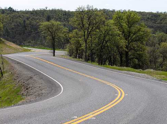
It really does say Curves 130 Miles, and it's a famous sign in local riding circles. Everyone has to get their photo with The Sign. The road begins a slow rise in elevation to Platina and winds back and forth in a spirited ride along a creek bed- a definite motorcycle paradise without the dangers of canyon riding to worry about.
Dibble Creek Outpost is located 5 miles from the eastern end of Highway 36. Perfect quick stop for gas, eats or some quick snacks from the road. Dibble Creek Outpost had their grand re-opening in 2023 with a brand new fuel station and full-service restaurant. The Outpost even boasts live music at times. Dibble Creek Outpost is the only fuel along the 140 mile length of Highway 36 other than Dinsmore & then Carlotta at the very western end of Highway 36. There is no fuel anywhere in the mid-section of Highway 36 other than a detour into Hayfork. Distance between fuel stations is 90 miles between Dibble Creek Outpost and Dinsmore.
Twenty plus year ago, I was roaring westbound out of Red Bluff on my nifty new Yamaha FJ1200 happy as a clam. It was blue, it had horsepower galore, and it was a looker. Outside the Red Bluff city limits sign, there appeared a small up and over hill.


Dibble Creek Outpost is a brand new fuel station and restaurant 5-miles from Red Bluff on the eastern end of Highway 36

It had such a crest to it- the bottom dropped out and all of a sudden, I was a quite alarmed to find my 600 lb sportbike airborne over this rise like something out of the Isle of Mann TT. And a right-hander at the bottom. I made it around- but it was quite a wake-up call, and I may have needed to unclench a few choice muscles.
There were plenty of scrapes in the trough-like bottom of the hill from all the cars bottoming out. Road crews have since removed this 'jump' in the road, as CalTrans figured out this corner had 10x the accident rate of a normal corner. It's probably good they did, as the crashes occurring from this rise were beginning to mount. But there are several more to come. Think of the experience of Highway 36 as three chapters.

Chapter I: Red Bluff to Platina
The first portion headed westbound out of Red Bluff shown in the pics above involves excellent pavement. But it's more than that.
The road hugs the terrain. Roller coaster style.
Nobody bothered to bring the bulldozer when they created this first section. Instead, it was simply graded smooth, and the road crew called it a day. The benefit is this terrain is like no other road in all of California. The road rises and falls over low hills- some maybe ten feet high- then it snakes around and straightens out. At first hugging Dibble Creek snaking along then gaining some elevation. These hills are what the riders below are commenting on. A couple straights, a meadow, and plenty of cows grazing alongside the road. Easy on the speed. Remember, this is a main highway.

While I can't tell you how fast to go, or whether it's wise to push the envelope on a section of road like this- that you'll have to make your own judgment on. But I promise you. You'll hear that whispering in your ear from the little guy that lives on your shoulder. Not the white guy. The red guy. So, ride at your comfort level and live to ride another day.

At Cannon Road, the road takes a hard 90 degree right and heads up a low hill. Another one of my favorite parts of this road. Some of our favorite all-time rides are not the canyon rides- but actually the ones resembling a roller coaster ride. Another 90-degree corner left and on you go, westward bound.
Another mention of caution for eastbound riders (headed to Red Bluff) who'll be doing the downhill in this section- There are often skid marks in these corners- some headed right off the road and down the hillside.
Too hot, you'll need a fistful of front brake to slow your momentum. While you may have no idea which corner I'm talking about right now- you will once you go ride this.
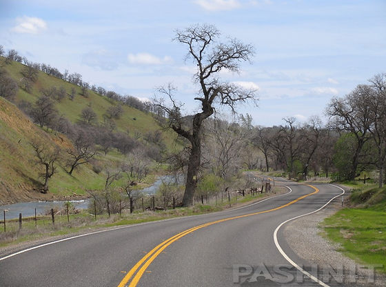

After 17 miles from Red Bluff laden in frivolity, Highway 36 comes up on its first intersecting road. This is Bowman Rd, which doubles back to I-5. If you have a choice, skip it. A second word to the wise is don't take Bowman Rd westward to make time, and cut off the far eastern 17 mile section of Highway 36 outside Red Bluff. You'll regret that. Instead, make the trek south on I-5 to Red Bluff, and don't miss out on one of the best stretches of this 140 mile joyride!
From Rosewood to Beegum Highway 36 evolves into a series of twisty bits, then a straight section. Few miles, then back into the twisties. Then a straight. This seems to repeat itself several times over, but it never gets old. What you may also notice is the advent of more hilly terrain. This is but a precursor.

No mountain ranges yet, but you'll be able to see them getting closer on the horizon as this hilly terrain begins to close in around you. Then, popping over the next hill, there it is- an entire mountain range, a line in the sand as it were. Highway 36 falls into this valley, then springs out through a series of thrilling 180 corners. Smooth. Climb up to the top of the range 1000 feet in elevation, and look backwards (eastward) nearing the top. Not a bad view after all.
Right at the top of the hill is Platina Rd. This rather unassuming ride is easily passed over by its Big Daddy Highway 36, but someday if you have the time, make the trip to Igo (yes, that's the town name) and be amazed. I was. Platina Rd falls under the 'Why didn't I ride this sooner!?' Explore it (or simply click over) and you'll realize what I mean.


Highway 36 viewed from Platina Rd
Chapter II: Platina to South Fork Mountain
The one building town of Platina dates to 1902 and welcomes you at the top of the hill a few yards past Platina Rd. There is the Saint Herman of Alaska Monastery here at Platina, south from Highway 36 directly across from Platina Rd down Beegum Gorge Rd (2 miles in on dirt). Herman of Alaska was a Russian Orthodox monk and missionary to Alaska in the late 1700s. There used to be gas here at Platina, but in present day, it looks abandoned. Not a soul around. For eastbound riders, there is gas right as Highway 36 reaches the edge of Red Bluff at the new Dibble Creek Outpost. Doubtful the Platina General Store will ever return.

The first portion of the ride is over and Chapter 2 begins. Now picture mountains in your mind's eye. Tall ones, jagged ones, pine tree studded ones. Now add the motorcycle. The imagery should plain add up to curves and more curves. Leave Platina and sure enough, the terrain is changing over to pine trees and more of a mountainous terrain. It's a 20-mile jaunt to the massive Highway 3 intersection we call The Triangle (for obvious reasons). One of those 'We'll meet you at The Triangle' sort of conversations with your buddies when leaving Platina.
Wildwood Road & The Natural Bridge
It's worth noting that in the middle of this 20-mile joyride is Wildwood Rd (aka Forest Rd 3). Another easily missed ride, dwarfed by roads like the Almighty Highway 36. Wildwood is nothing like Platina Rd though, Wildwood Rd is a paved goat-trail-short-cut on over to Highway 3 and bypassing Hayfork emerging to the northeast of the town. It's scenic though in a narrow mountainous valley with a ranch in the middle, each time I envy the fella that lives there. Note if you take Wildwood Rd to reach Hayfork Pass, this shortcut bypasses a super-twisty section of Highway 36 and Highway 3. Wildwood Rd also bypasses the highest elevations along Highway 36 where elevations bump over 4200’. (South Fork Mountain Summit only reaches 4077’.)

There used to be the Wildwood Store here a decade ago, a small general store and restaurant. We actually took the entire Pashnit Tour group here for lunch one year, the owner was a huge motorcycle nut and there was bike stuff everywhere, including an old Honda out front on the sign along Highway 36. The Wildwood Store burned to the ground a few years back and was replaced with a small camper and some picnic tables. The camper evolved to a tiny house offering snacks. It's a well-deserved stopping point along this journey.
Note on Wildwood Rd, there's a natural bridge that's worth checking out to the west up Bridge Gulch Rd. The Bridge Gulch turnoff for FR31N19 is located 13 miles north of Highway 36 or 5 miles south of Highway 3. There is a sign but you’ll have to be watching for it. It points up a single lane dirt road headed west.
The road to the Natural Bridge on Wildwood Rd is a short distance of dirt
The dirt road Y’s a mile from Wildwood Rd and there is no sign here to tell you to stay left. (Mapping programs also don’t even show a road here exists.) If you miss this turn and continue due west, you’ll be headed up single-lane dirt fire roads over the range to Hayfork. Stay left at the intersection and the road gets a bit hairy for motorcyclists, rocks and ruts to concentrate on. The dirt access road leads to a dirt parking area, again no signage. The path to the natural bridge is at the far end of the small parking area, follow the trodden path.

The Natural Bridge is a natural limestone arch spanning across this narrow ravine by nature. The exterior mass of the bridge was solid until water, through the course of time, forced itself through and under the soft limestone, creating the passage. This detour is well worth the time, and it’s easily missed by just about everyone. The site is also the location of the Bridge Gulch Massacre, known as the Hayfork Massacre or Natural Bridge Massacre, that took place on April 23, 1852
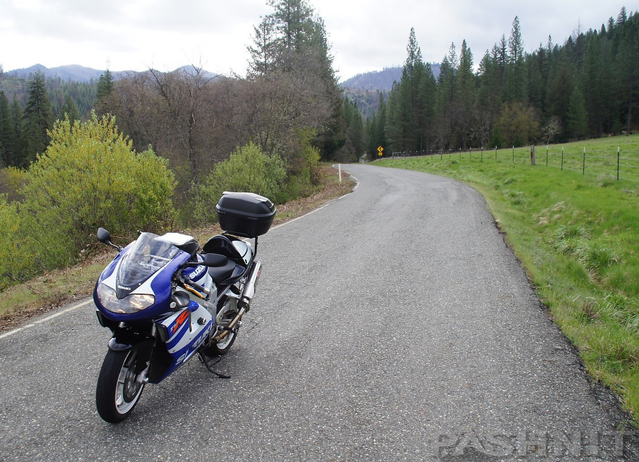
Wildwood Rd is a fun shortcut over to Highway 3 Hayfork Pass
The Natural Bridge is 150 feet long and a 30-foot-high rock arch. The exterior of the opening measures about 100 feet wide and 50 feet high. The archway spans over 200 feet. The scale of the arch takes some acclimation, it is massive.
The turnoff is located 13 miles north of Highway 36 at Bridge Gulch Rd and then 1 mile up dirt fire road FR 31N19. The turnoff is marked and leads to a small dirt parking area and trails leading to the natural bridge.
There used to be the Wildwood Store here a decade ago, a small general store and restaurant. We actually took the entire tour group here for lunch one year, the owner was a huge motorcycle nut and there was bike stuff everywhere, including an old Honda out front on the sign along Highway 36. The Wildwood Store burned to the ground a few years back and was replaced with a small camper and some picnic tables. The camper evolved to a tiny house offering snacks. It's a well-deserved stopping point along this journey.
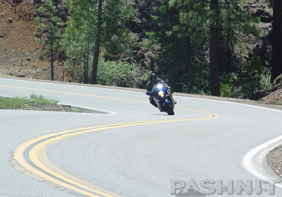
This is much different country than what you've experienced with the rapid elevation changes found in the Sierra Nevada Mountain, roads like Highway 108 & Highway 4. These NorCal mountains are lower in elevation. Passes may reach 3000-4000 feet at best (this section peaks at around 4200 ft). But there are still plenty of pine trees, drop-offs, and blind corners.
Whoever designed this road- they must have been a motorcyclist. Banked corners? Not many of those around. Absolute thrilling ride. Great pavement through here too.
And the view! Amazing views. Intense views. Great views in this up and over mountainous section between Wildwood Rd & the Highway 3 junction. While this section is only a 10-mile jaunt, it's one of the best in the whole 140 miles. Combine the view northward (pic at right) with the curves below- yes Virginia, by far the best motorcycle road in the state


This photo, and the one below, are the same section of road, photographed respectively from each end looking at the set of slalom curves.
Be on the lookout for cows on the road, as in, smack dab in the middle of the road. Almost hit a cow once on this road. I don't know who was more scared, I or the cow. Not to mention his 3 buddies, and at dusk to boot. You may have yet to see one in the road, but if you ride long enough, it'll happen. Deer of course are just as plentiful.
.jpg)
The photos cannot lie - Endless curve for 140 miles - and yes, same set of curves as the photo above.
The Triangle
After 67 miles of non-stop twisties, the midpoint of Highway 36 is the massive triangular intersection (The Triangle) with Highway 3 which heads north on a very pleasant ride north up to Hayfork and then over the wild undulating ride of Hayfork Pass. It's worth mentioning that Hayfork Pass is likely one of the best motorcycle roads in Northern California. Not too long, not too short, endless twisties, knee drag corners, and minimal traffic. Be sure and read the write-up for this super-fun road.
Highway 3 then joins up with Highway 299 (do ride the Trinity River Canyon if you have the chance) for a few miles, then continues northward past Clair Engle Lake for the northward portion over Scott Mountain Summit, past Gazelle-Callahan Rd, and up to Yreka.

Pashnit Motorcycle Tour group at The Triangle, junction with Highway 3 & Highway 36
Another great ride all the way up to California's northernmost east-west ride- Highway 96.
West of Highway 3, the road is swallowed up by the depths of the Shasta-Trinity National Forest. You'll begin to realize this is a rather long ride and may take the better part of an afternoon to do. It's 18 miles to the South Fork Mountain Summit (from Highway 3). I once followed a rider on a Ducati Streetfighter V4 through this section on my Hayabusa and couldn't keep up with him. He was railing and super smooth. I couldn't figure out how he was able to ride so briskly. Then we switched bikes. Okay, I get it now. Years later, I got a Z1000 and jumped feet first into Streetfighter bikes.

Highway 3 The Triangle to S Fork Mtn Summit has fast smooth curves you will love.
August Complex Fire
In August 2020, a massive lightning storm swept across California. This storm generated over 12,000 lightning strikes in 72 hrs starting over 560 fires. All burning at the same time. Many of them merged into massive conflagrations. One of these August 2020 fires was the August Complex Fire south of Highway 36 that burned mostly in wilderness mountainous regions. Originating as 38 separate fires, the August Complex fire became the largest fire complex in California history burning over 1,032,648 acres, roughly about 1614 square miles of forest land, an area larger than the state of Rhode Island. The fire jumped Highway 36 in the center section of the road in between the South Fork Mountain Summit and The Triangle, where Highway 3 heads north to Hayfork. While there is a lot of salvage logging going on along Highway 36 in the center-section, the twists and turns are unchanged.

Results of the August 2020 Complex Fire between The Triangle and South Fork Mountain Summit along Highway 36
One of the highlights of the ride is the mountain range(s) in the middle of the ride. The ride zooms up hill, tossing back and forth on up to the 4,077 ft. South Fork Mountain summit within the Trinity National Forest. We've been up here multiple times with snow on the ground, and the time I led the Cycle World Magazine editors tour, it was snowing at the South Fork Mountain Summit during mid-April.
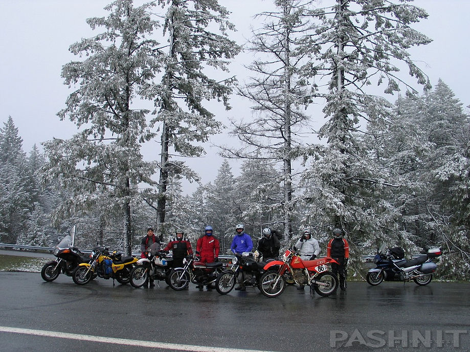
Cycle World Magazine Editors Ride on South Fork Mountain Summit in April
Horse Ridge Lookout Rd
Take note of Horse Ridge Lookout Rd at the summit of South Fork Mountain. This narrow one lane road is paved up the ridge to the south for 6.5 miles. It's an out and back spider road if you have the time, but well worth running up the ridge to check out the view. Some stretches of pavement along Horse Ridge Lookout Rd are poorly maintained and potholed, but the view is spectacular.

Horse Ridge Lookout Rd leads south from Highway 36 to a spectacular view.
South Fork Mountain Summit
You are standing on what is generally known as the longest continuous mountain ridge in the continental United States. South Fork Mountain stretches 46 miles at a relatively even elevation from Grouse Creek to the north to the headwaters of the South Fork Trinity River on the southern end. The northeast slope covers about 80,000 acres that bear remarkably uniform characteristics. This ridge is bounded on the east by the South Fork of the Trinity River- a federally designated Wild and Scenic River- and on the west by the Mad River and Ruth Lake. Through ecosystems management practices, these sensitive watersheds and their rich forest resources are maintained.
South Fork Mountain Summit.

Chapter III:
South Fork Mountain to Hwy 101
There are 30 miles of twisties from the Highway 3 Triangle to Mad River. At Mad River at the church is the south end of Forest Road 1, better known as South Fork Mountain Road and then Titlow Hill Rd where it meets Highway 299.
Highway 36 flowers before you like a garden blooming in spring as you head westward down from the 4077 ft. South Fork Mountain Summit. Banked corners? Very few roads are paved in this manner.
The perfect motorcycle road? Record this sequence in your mind's eye. You'll be thinking about it for days afterwards. Days later, you'll be able to close your eyes and feel the sensation of the bike rolling side to side- rocketing through the banked undulating twisties.
South Fork Mountain Summit, elevation 3447 ft

Lower Mad River Rd & Van Duzen Rd loop around Ruth Lake back to Highway 36
Ruth Lake
At the western base of South Fork Mountain summit is Lower Mad River Rd, and two miles further west is Van Duzen Rd. Both roads connect to Ruth Lake, although you want to use Lower Mad River Rd if the intention is to reach Ruth Lake. I have used Van Duzen - Lower Mad River Rd as a loop to add mileage to Highway 36 with motorcycle tour groups, but remote backroads are not for everyone.
Van Duzen Rd also connects to Ruth Zenia Rd to reach the remote mountain town of Zenia. At Zenia, Zenia Bluff Rd connects back to Alderpoint Rd. It's a very remote loop to Zenia and my write-up suggested the majority of riders should skip this connection out to Zenia and on to Garberville. I rode it on my TL1000R, but I allowed 4 hours to ride 71 miles. Much of this region around Ruth Lake and over to Zenia burned in the 2020 August Complex Fire.
Mad River Burger Bar
The first time I considered the Mad River Burger Bar as a planned lunch stop for a Pashnit Tour group, I did the usual poking around and started reading reviews. The food was great but the staff was super rude read the reviews. Sweet! The reviews were several years old. The mere thought that some random person was annoyed by someone handing them a delicious burger was enough to convince me to take the Pashnit Tour group here to Mad River and see for myself. Would they scowl and complain, damn bikers! The whiny reviews were enough to convince me to try it out for myself. The Mad River Burger Bar is not a bar, rather it's trailer with a grill within and a counter to take orders. It's been the only business in Mad River as long as I can remember. And it's always busy.

Looking for a sit-down restaurant anywhere along Highway 36? There aren't any. But there is road food. And it's good!
The sign in Mad River says, 'Don't Blink or you'll miss us' and it's fitting. I've been riding Highway 36 for years and always blown by this place, always in a rush. Don't be. Stop. It's worth it. Road food served to you pipin' hot out of an old camper? That's NorCal. And they have ice cream.

Dinsmore is the last fuel on Highway 36, until Dibble Creek Outpost near Red Bluff
Dinsmore is a tiny roadside fuel station and general store. It is the only other fuel along Highway 36 other than the new Dibble Creek Outpost on the far eastern end of Highway 36.
Back in the olden days, say prior to 2017, there was a narrow no-center-line section of Highway 36 that we loved between Dinsmore and Alderpoint Rd lasting about 10 miles. Fast, swoopy, and beloved, it was all taken out by CalTrans in the massive road straightening project that ran 2017-2020. The irony is the road straightening project at Dinsmore did very little straightening. Instead, CalTrans admittedly far exceeded any motorcyclist's wildest dreams creating a super-fast, smooth and curvaceous section of road completely reshaping and re-engineering this stretch of road. We expected the worst, straight lines and sleepy time results. Nope. In true Highway 36 spirit, the brand new road is super fast and super fun. The construction is finally done and you're gonna love it.

Brand new pavement Dinsmore to Bridgeville - Dreamy!
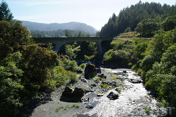
Twin bridges at Bridgeville are worth checking out
Do stop every now to take in the view and stretch your legs. Plenty of great views like the one above. Along the edge of Rattlesnake Creek into the tiny Forest Glen and over the South Fork of the Trinity River and then up and over the South Fork Mountain range to Mad River along the banks of the... Mad River. At Mad River, you will find South Fork Mountain Road. Click the link to see what all the hub-bub is about. Forest Rd 1 is not for everyone, but some may love it
Finally, we settle in with the Van Duzen River through the small town of Cobbs. Nearby is Bridgeville, CA, the town that back in 2002 was sold on Ebay.com for 1.8 million dollars, the first time such a thing has ever happened. The former owners, packed up and moved to Fortuna. As of 2024, the town spanning 81-acres is still listed for sale for $1.5M.
Kneeland Rd starts at Bridgeville and connects north. The first 20 miles are dirt, but the (poor) pavement resumes near Tom Shaw Rd and the Kneeland Cemetery. However, Kneeland Rd is the only back way into the east side of Eureka and if you use it to continue north, you can reach can reach Highway 299 at Blue Lake via Maple Creek Rd (paved).

Headed east on Highway 36 at dawn into Mad River. Alderpoint Rd is accessed via this summit at Bridgeville.
Also, at Bridgeville, you can ride Alderpoint Road southward to Garberville. Avenue of the Giants is just over the hill to the west. Alderpoint Road is paved the entire way, and a bit of a surprise, deserted, unknown, and undiscovered. Alderpoint Rd is a bumpy backroad, but shortcut over to Garberville, however, it can be an ordeal. One rider on a Pashnit Tour made me promise never to ride Alderpoint again on a tour, rattled a few teeth loose, he said. North from Bridgeville is Kneeland Rd, but this is not paved until it reaches the Kneeland Airport. As for Highway 36, the translation of all that gibberish above is a wondrous ride. These low mountain ranges aren't like what you're used to. I could describe the rest of the ride out to Arcata in detail but needless to say- you really ought to just come out and ride it yourself.
Years ago, the road was in pretty rough shape in this western portion and was a deterrent to commercial shipping. But the road crews have been hard at work, and you may notice several new road cuts into the hillsides. This last portion is another mountainside style road. Cliffs, drop-offs, non-stop corners, you know- that sort of thing. The great thing you may not realize is that Highway 36 has a lot less traffic than its counterpart to the north Highway 299 and that's a good thing for you and I. Highway 96 has even less traffic.
Grizzly Creek Redwoods
Grizzly Creek Redwoods State Park is 29 miles from the 101 Freeway, this state park comprises 400-acres of old growth redwoods with riverfront camp sites & hiking trails. We don't see people trying to walk across the highway in here, but there are trucks pulling out with campers occasionally.
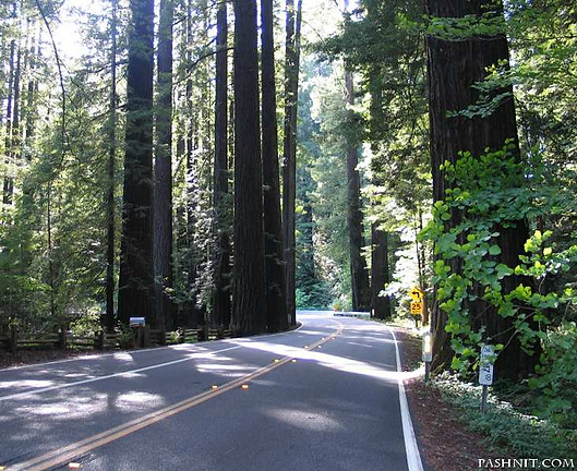

Getting close to the Pacific Ocean, Highway 36 slaloms through Grizzly Creek Redwoods State Park at first light - no shadows.
And no other people on the road.
Owen Cheatham Redwood Grove
Minimal time and you want to immerse yourself in the redwood forest? Set the GPS for Cheatham Redwood Grove along Highway 36. This easy to miss redwood grove is found 4 miles west of Grizzly Creek, and 8 miles east of Carlotta. There's a tiny parking lot on the north side of the highway and a tiny sign that's easy to miss. Cheatham Grove is found in a near circular 360-bend of the Van Duzen River creating a flat alluvial grove environment that redwood trees thrive in. After a flood, fresh sediment is distributed into a redwood grove, the trees have the ability to reverse their root systems by growing up into freshly deposited sediment from the most recent flood.
The ground cover here is especially lush with the colors in this forest being an explosion of green. There's a short .7-mile out-and-back looping walking path through the grove that is flat and well-maintained. The forest is wide open yet the ground cover is a brilliant carpet of redwood sorrel with a dense layer of ferns common to redwood forests. The tiny parking area for Cheatham Grove is also the only place in Grizzly Creek or Van Duzen Parks where it's free to park and no one is going to bother you on your motorcycle.
Worth mentioning, Cheatham Grove is one of several filming locations for the Star Wars films. The most memorable parts of the speeder bike chase from the Star Wars movie Return of the Jedi, in particular the forward-looking Steadicam shots, were filmed in this grove in 1982. Even more scenes were filmed nearby, use StarWarsLocations.com to find other local spots from the film in Northern California.
.jpg)
Owen Cheatham Redwood Grove
.jpg)
Highway 36 ends at the 101 Freeway. We have been basing our Pashnit Motorcycle Tour groups in Fortuna for the last 20 plus years due to the convenience of Fortuna being central to the area. Don't miss the Eel River Brewing Co at the Riverwalk exit just up the road. This brewery has been churning out product for years, offers great food, and can handle a large group of bikers.
At the western terminus of Highway 36, north heads into Fortuna and Eureka. South heads towards the Avenue of the Giants and back out to the ocean via Highway 1. The Lost Coast - Mattole Rd is nearby.
Owen Cheatham Redwood Grove
If you have the time, ride out to the sleepy little Victorian town of Ferndale near the Pacific Coast. It's only a few more miles once you hit the101 freeway. Another hint about Ferndale, take Centerville Road (southwest corner of town) westward to the ocean and ride this dead end road up above the ocean along the bluffs. Great view. Then do The Lost Coast - Mattole Road and ride through Humboldt Redwoods State Park to the Avenue of the Giants.
More Thoughts:
(webmaster note: still one of the funniest road reviews ever written, if this doesn't make you want to jump off the couch and go riding, don't know what else will:)
This road was one of the scariest drives I have ever been on. Four hours of pure hell. I asked at a gas station if 299 or 36 was better to take from Redding to Eureka, he said 299 had slides, but 36 was a nice scenic road. Seriously ?? I thought for sure we were going to die. .... it was awful. SCARY STUFF . Don't ever drive this windy, too narrow, no guard rails, up and down, hairpin curved, backwoods piece of crap thing California calls a road. - Daneen
One regret, Harleys are the wrong bike for this road. - Fraz

What's waiting for you at the western end of Highway 36
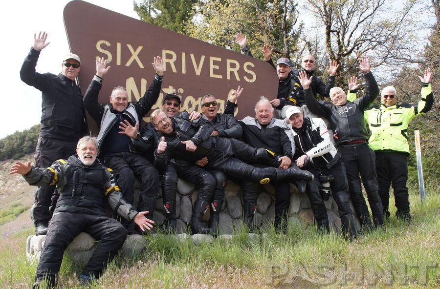
Pashnit Motorcycle Tour group on the South Fork Mountain Summit on Highway 36 - Come ride with us!
Highway 36 - Bonus Photo Gallery
MORE INFO: Highway 36
RIDE IT on a PASHNIT TOUR
140 Miles - LENGTH
Dreamy, maintained state highway, very good- PAVEMENT
1800 of them, smooth, constant, elevation change - CURVES
Fortuna, Carlotta, Dinsmore, Dibble Creek - GAS
Fortuna, Red Bluff - LODGING
5000 ft - PEAK ELEVATION
GPS LOCATION
40.1784886 -122.23583020000001- East
40.54665605516752-124.14395466038462- West
LISTED CONNECTING SIDEROADS:
Platina Rd
Wildwood Rd
Highway 3 - Hayfork Pass
Horse Ridge Lookout Rd
Lower Mad River Rd / Van Duzen Loop
Forest Road 1 - South Fork Mountain Rd / Lamb Grade
Alderpoint Rd
Kneeland Rd (dirt)
Additional RESOURCES
Saint Herman of Alaska Monastery, Platina, CA
Grizzly Creek Redwoods State Park
Bridgeville Zillow Sale Listing
Highway 36 Road Conditions

Maps
