Northern California

Calaveras County, California
Jesus Maria Rd
15 Miles - Length
Calaveras - COUNTY
single lane paved- PAVEMENT
CA Foothills, - CURVES
Mokelumne Hill - GAS

Quick Ride: Fun single-lane paved backroad connecting Mokelumne Hill with Railroad Flat Rd
Riding Calaveras Backroads
Has anyone ever told you to do something, but you never got around to it? Days and months pass, even years, and all the while that one thing remains, lurking in the corner of your mind.
Jesus Maria Rd was just that for Yours Truly. It's another one of those foothill rides where you really don't have any reason to be there... unless you're the exploring type. Or the 'crossing-off-roads' type. Or maybe you just happen to be in the area, and spy this one on the map. Looks curvy. Wonder what it's like? Let's go find out.


While you never know what you'll get out in the foothills of the Sierra Nevada Mountains, Jesus Maria Rd may surprise you. Some years back, I was poking around and came upon a road called Fricot City Rd near San Andreas. There I was tooling up this one lane deserted backroad, that slowly deteriorated until it turned into gravel at the Rite of Passage ATCS, then I simply turned around. Which doesn't happen very often. Okay, so the score is 0 and 1. Need to redeem myself. (Fricot City Rd connects to Sheep Ranch.)
This region of California holds a treasure trove of roads to choose from, from deserted two-lane for the two-up cruiser, to the more adventurous types that feel the need to get far away from everything. And there are no shortage of gravel ranch roads spread across this elevation band.
Keep in mind, roads like Jesus Maria are very common in the foothills of California, and most everything you see dates back to the Gold Rush. Anytime a strike was discovered, it rarely stayed unknown for very long and miners would flock to the area.
In turn, these sudden mass-migrations created a spider web of roads into these rolling hills that is unlike any other region of California. The gold eventually played out, but these early Argonauts left behind a region of California that's a playground for the two-wheeled aficionado.
I had heard about Jesus Maria Rd several times over the years but never got a chance to get over to this region to give it a whirl. And aside from the odd name that left me wondering what the origin could be- I have to admit I really enjoyed this one. Although wondering all the while about the name of course. The community of Jesus Maria along Highway 26 was originally the center of a large placer mining operation, and was named for a Mexican who raised vegetables and melons for the miners.

You can reach Jesus Maria Rd from Mokelumne Hill, (pronounced mow-kull-lah-me), a small historic town at the major intersection of Highway 26 and Highway 49. The intersection is just that, a mere hill with an intersection on it. The actual town, albeit tiny, of Mokelumne Hill is below the intersection to the northeast. The intersection itself has gas & some quick eats if you don't need much else. Otherwise, head down onto Main Street and find some good eats along this historic town.
Mokelumne Hill once had placers so rich in gold, claims were limited to a mere 16 square feet. Claims produced so much gold, miners refused to leave. When miners ran out of provisions, they risked starvation rather than risk leaving their claim and head down the hill to Stockton to obtain food to eat. A mere 4-foot by 4-foot claim yielded as much as $20,000 in gold. The easy gold also attracted a criminal element, and by 1851, there was at least one homicide per week for over four months straight. The town today is a mere 700 people, but is said to have held 15,000 during 1850 comprising a multi-language melting pot of Americans, Frenchmen, Germans, Spaniards, Chileans, Mexicans, and Chinese. You'll also find the first three-story buildings ever built in the foothills here, made out of tuff stone, a stone common throughout the foothills. The church here in town dates to 1856. The town was destroyed in the Floods of 1862 but quickly rebuilt.
.jpg)
Mokelumne Hills also lays claim to two ‘wars’, which were more likely disagreements between bands of miners, one taking place on French Hill where French miners erected their native flag which the locals didn't take kindly to. In another incident, a miner decided to stake claims in the names of his employed laborers rather than his own. Locals weren't inclined to tolerate the attempt at fraud and overran the miner's claims.
Mok Hill is also said to be a former haunt of Joaquin Murrieta, a name you'll hear often throughout the foothill regions of California. The legend goes, a miner strolled into a saloon and slapped down $500 in gold nuggets betting he'd kill the bandit the first time he ever saw him. A Mexican miner jumped up from his table, grabbed the $500 of gold, and said "I'll take that bet" and ran out the door. The braggart miner lost the bet.
Joaquin Murrieta was eventually hunted down and killed in a shoot-out with 20 California Rangers, the state’s first statewide law enforcement agency, hired to find and kill Murrieta. To collect their $1000 reward, the Rangers put the head of the elusive bandit in a jar of alcohol and the head was put on display, spectators paid the sum of $1 to view the head. The head in the jar was eventually lost in the San Francisco 1906 earthquake and fire.
The deeds of the bandit Joaquin Murrieta years later became the inspiration for the story of the fictional character of Zorro, first published in 1919.


In later years, Mokelumne Hill was the home to Lucile Davidson, said to have the largest glass shoe collection in the world during 1959-1977, gaining inclusion into the Guinness Book of World Records. The current record holder has nearly 15,000 pairs of shoes.
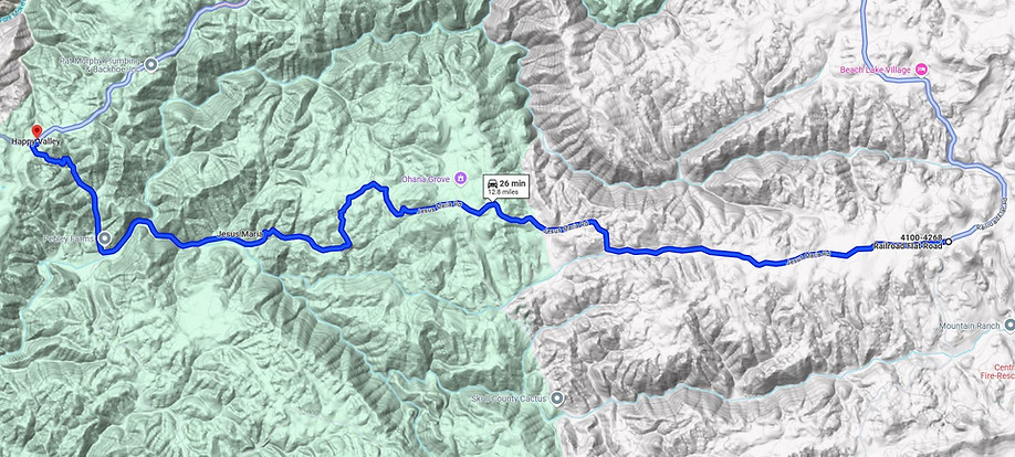
After taking in Mokelumne Hill, ride up Highway 26, and you'll see the sign for Jesus Maria Rd right at the Hertzig Mini Storage. The ride is 1.5 miles outside of town to the east and 7 miles below Glencoe.
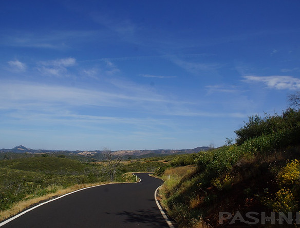
Jesus Maria Rd has a Y-shaped double entrance on the east end at Highway 26. The last time I rode this, I arrived before the sun actually came up, the glow of my headlight still lighting the way. But the timing was perfect, and within moments, darkness began to fade, revealing an enticing road. The photos have this color because the sun hadn't come over the horizon yet. It's the way the world looks at 6 AM, quiet, undisturbed, and placid.

All those souls slumbering away in their beds, and the lone motorcyclist tooling up this deserted narrow road. The sound of the exhaust note overtaking the still morning. The air is in the 40s, cool, crisp, and I can see my breath each time I stop to photograph the scene. And then a moment later, I sink into that familiar lean... on to the next corner. Me, myself and I. Jesus Maria is one of the few single-lane-paved-roads that does not turn into gravel, and it connects all the way to Railroad Flat Rd.
There's the requisite historic cemetery located along Jesus Maria Rd, two miles up the road. Along with a state historic landmark sign, although the plaque is long missing.
Also, 2 miles in is a sharp blind left at the intersection of Hawver Rd as the road meets up with Jesus Maria Creek. This is a single lane gravel ranch road, but connect south to San Andreas.
Keep an eye out for deer, of course, I saw quite a few along this ride. Plenty of open spaces, thickets, and gullies for them to feel at home in. If you come blasting around a corner, you may find one, or several, right in your path. But no cows, at least not in the middle of the road on this ride.
.jpg)
As for the elevation, the ride drops into the canyon and begins climbing from 950 feet to 2600 feet. In the throes of summer, the foothills can be quite hot, and this isn't the place to escape from the heat. You'll need a much higher elevation (3000+) for that, but as long as you're moving, the heat can be bearable.
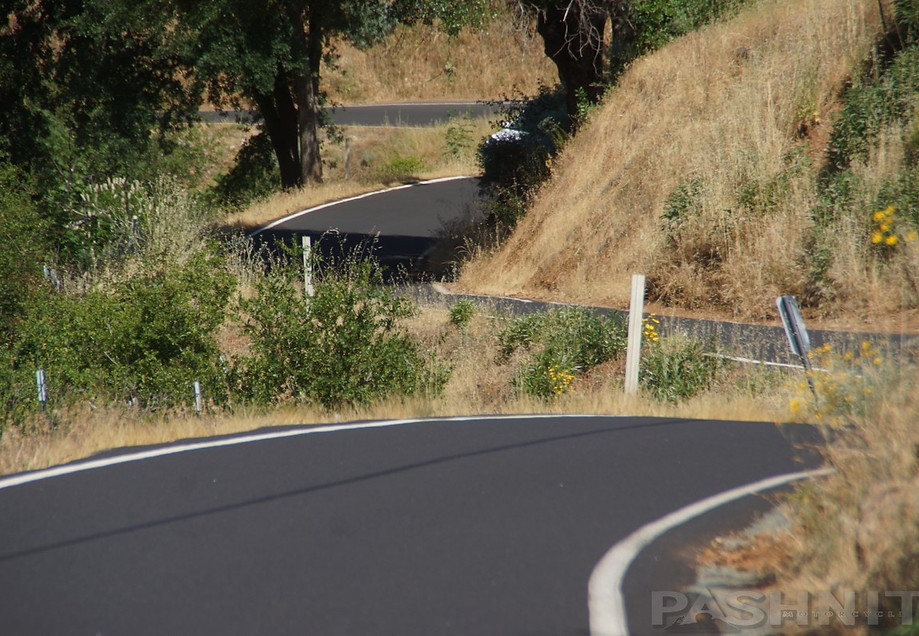
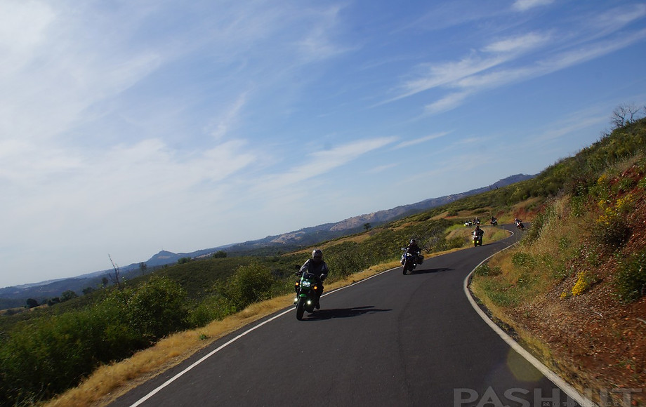
As for pavement, if you enjoy the single lane paved foothill roads, this may rank right up there. The pavement surface was better than I expected. You never know what to expect on a ride like this, and I'm sure this road has gone through its share of rutted, potholed, and patched years. For now, it's adequate, and although your speed may never get very high on this 12-mile jaunt, it's a ride for the books! A steady, relaxed pace is the order of the day. The view alone will slow you down.
This climb in elevation is a combination of scrub and trees. Not quite high enough to make it into the pines, but high enough to escape the prairie Savannah of lower elevations. The low scrub bush common to this area allows up a thrilling view that'll leave you wondering, "I'll put my house right over... there!" A few miles later at a clearing, the maps labels this as Jesus Maria, but all I saw was an old barn and a home tucked back away from the road.
_JPG.jpg)
While the lower portions of Jesus Maria Rd follow along Jesus Maria Creek, as the road pushes deeper into the foothills, there are several spots that'll have you pulling to the side of the road and shutting down the motor. Which is the usual occurrence while I'm rolling along, break through the trees, and there it is. In several places, the view extends off to the south to the next ridgeline, then up and over to the other side of the ridgeline.
About that time, 7 deer jumped me. It happens. Like cattle up here. But go-go speed racer was keeping the pace down today, and ample time to grab a fist-full of binders. Out comes the camera, of course. Always nice interacting with the locals. If you are well-traveled through the foothills, you may even recognize some of the surrounding hilltops that line the Highway 49 region, I know I did.
Take note of Whiskey Slide Rd. This is not paved for the first mile southward, but it is a paved one-lane goat trail thereafter, connecting to Mountain Ranch Rd 6 miles distant.
On Jesus Maria Rd, after cresting the ridgeline, the ride drops back down and finally falls out of the trees. The sun came out and morning had arrived. You're getting close to the end when the driveways begin to increase and the road surface improves a bit. Two miles from Railroad Flat Rd, the single lane ends and Jesus Maria expands to a wide two lane road into a country residential neighborhood. A moment later, Railroad Fat Rd arrives, another of my personal favorites.
A ride like Jesus Maria Rd isn't for everyone. It doesn't go anywhere in particular, it's not the ultimate thrill ride, and it's really just a deserted backroad. Then again, maybe that's the draw and that's all you really need to know. Jesus Maria Rd lies in the middle of what some might consider to be a motorcycle paradise - regardless of your ride style or type of motorcycle. Found in the heart of the California Foothills, and surrounded by Gold Rush history in all directions, you could probably spend weeks here and still not ride them all- I know I've spent years trying to cross them all off.


Running parallel to Jesus Maria Road lies Highway 26 & Highway 88 to the north. Another unknown backroad, Clinton Rd is worth checking out too. And the always fun Mountain Ranch Rd lies to the south. Note that Whiskey Slide Rd connects with Mountain Ranch Rd. A short portion of the northern end is not paved. Another option is to take Sheep Ranch Rd (very much a backroad) due south into Murphys to reach Highway 4 - Ebbetts Pass.
Often, I'm trying to find the best paved route that's deserted and little used. Keep in mind, several of these are narrow one lane roads, but all paved. If you're not in any hurry, have no place to be, and want to indulge in a great ride, cross-reference this against a county-level map. (Some of these roads won't be on anything less-detailed, and GPS is even more confused if roads are paved or gravel.)
If you're riding into the foothills, and headed northbound, note that Stony Creek Rd just outside Jackson is another thrilling ride to extend this frolicking time on the motorcycle!
2015 Butte Fire
Note that the 2015 Butte Fire burned this region, the fire spanned 70,000 acres, destroying a total of 921 structures, including; 549 homes, 368 outbuildings, and 4 commercial properties. The fire started outside Jackson and spread southeast towards Highway 4 reaching almost to Railroad Flat. Regions around Mountain Ranch were especially hard hit. Some rebuilding has taken place and the fire scar has faded, but when you intersect Railroad Flat Rd, this was the eastern edge of how far the fire reached.
Where to Next?
Northward: After Jesus Maria Rd, left turn northeast on Railroad Flat Rd through Independence and onto Highway 26.

2015 Butte Fire along Mountain Ranch Rd
Ride down the hill (enjoy the two canyon sections!), across Highway 88 - Carson Pass (gas here at the intersection) past Sutter Creek Rd into the historic town of Volcano. Beside the historic hotel, there's a little restaurant here serving lunch. North out of Volcano, Rams Horn Grade goes northeast to Daffodil Hill, Charleston Rd goes due north, across Shake Ridge Rd, and continue north on Hale Rd. Now here's a fun little backroad, one-lane for the majority, and a concrete water crossing mid-way (you'll only see water typically in winter/spring snow melts).
Keep in mind, the ride north out of Fiddletown is a bit hard to find, and labeled Jibbom Street. On the north end at Highway E16, the road is called Ostrom Rd, although some maps label this as Fiddletown-Shenandoah Rd. Highway E16 will continue through the wine-producing Shenandoah Valley, then all the way to Pollock Pines, or northward to Placerville.

Jesus Maria Rd on the east side is a wide two lane for the last two miles
Southbound: Railroad Flat Rd is a super fun motorcycle road- either direction. A turn southwest will flow right back down the hill via Mountain Ranch Rd and connect to Highway 49 at San Andreas. Sheep Ranch Rd is a paved connector to Highway 4 Ebbetts Pass. It starts off as a wide two lane but degrades to one of the poorest paved roads in the county. However, it's the only paved connector over to Highway 4.
Jesus Maria Rd - Photo Gallery
MORE INFO: Jesus Maria Rd
RIDE IT on a PASHNIT TOUR
15 Miles - LENGTH
Single lane, fair, can be patched & bumpy - PAVEMENT
Quite a few - CURVES
Mokelumne Hill - GAS
Sutter Creek, San Andreas, Jackson - LODGING
1437-2600 ft - PEAK ELEVATION
GPS LOCATION
38°17′08″N 120°38′51″W - Jesus Maria
LISTED CONNECTING SIDEROADS:
Hawver Rd (single-lane gravel)
Whiskey Slide Rd (mostly gravel)
RELATED INFO:

Maps


