Sierra Nevada Range, California

Nevada County, California
Highway 49
Nevada, Sierra - COUNTY
Well maintained State highway - PAVEMENT
Numerous, hairpins, steep grades - CURVES
Nevada City, Camptonville, Downieville - GAS

Quick Ride: Main highway and local proximity to Sacramento and Truckee make an enjoyable loop to use for all day riding, this pass is well-known but not busy enough to ever make it congested. The historic towns along this region such as North Bloomfield, Nevada City and Downieville make this a great ride with a heavy dose of Gold Rush flavor.
Riding Yuba Pass
Read Highway 49 - The Little Dragon
Always great fun to ride this one. With great pavement, plenty of resting places, the right number of towns every now and then all combine into an enjoyable afternoon ride. And with a terminus north of Truckee, it's a fast ride if you want to travel back to the Central Valley and head back into civilization on Interstate80. The pass is only 6100 feet so the low elevation means less snow and earlier open dates than the cousins Monitor, Ebbetts, Sonora & Tioga to the south. Yuba Pass is one of the most northerly mountain passes in the Sierra Nevada that is well-paved, well-maintained and has steady traffic on it. Note La Porte Rd and Oroville-Quincy Highway are to the north.
Yuba Pass for our literary interpretation starts in Auburn, however a hint for the motorcyclists... bypass this portion if at all possible. Highway 49 here is lined with businesses one after the other and there are multiple stoplights to contend with. There are several alternatives to bypass this boring straight and congested stretch of 4-lane boulevard out of Auburn to reach Yuba Pass. Use Highway 20 or utilize Highway 174 which starts in Colfax, and re-joins Highway 49 at Grass Valley if you have the extra time. Highway 174 parallels to east and is shorter, but requires extra time on the freeway to reach Colfax if headed out of the Central Valley.


McCourtney Rd parallels Highway 49 near Grass Valley
Another hint for the motorcyclist is if riding out of the Central Valley from Sacramento, you can parallel the I-80 freeway (& stay off it) by gluing several fun foothill roads together and re-joining Highway 49 bypassing much of the 4-lane boulevard stretch through Auburn.
Start from Loomis at I-80 & Sierra College. Head north on Sierra College Blvd > Hwy 193 > Fowler Rd > Virginiatown Rd > Chili Hill Rd > Crater Hill Rd > Wise Rd > Baxter Grade Rd > Joeger Rd > Bell Rd > Lone Star Rd > Lone Star Valley Rd > Lone Star Rd > Highway 49. This foothill route is fun, quick and avoids all the people and traffic.
Leaving Auburn behind, it’s a fast ride up to Grass Valley- but again, if you want to avoid the boring main highway as I often prefer, try a parallel trek to Highway 49. Start from Higgins Corner (near Lake of the Pines). Take Wolf Rd > Douglas Rd > Lime Kiln Rd > McCourtney Rd (pictured at left) > Indian Springs Rd to Penn Valley.
Here you can pick up Pleasant Valley Rd at Penn Valley to Bridgeport Covered Bridge on up to Highway 49 at Tyler Foote Crossing Rd outside Nevada City. These two alternate parallel routes from Loomis to Sweetland avoid all the towns, people, traffic and stoplights, something motorcyclists are usually interested in knowing about.
Grass Valley
In the early 1850s, Grass Valley was populated by a tiny handful of people. Cattle ranchers discovered the region after looking for lost cattle that had wandered into better grassy meadows spurring the name Grass Valley. By 1851, Grass Valley at the 2500 ft level swarmed with over 20,000 residents. Present day population sits at around 13,000. There is gas, food and lodging in Grass Valley. One of the best things to check out in Grass Valley is the Empire Mine.
Empire Mine
Empire Mine was one of the longest running gold mines of the Gold Rush Era, operating for over a century from 1850 to 1956 and is said to still contain millions of dollars of gold. The oldest, deepest, richest, and longest operating, it was also the largest hard rock mining operation in California pulling more gold out of the ground than any other mine of that era. Overall, the mine produced 5.8 million ounces of gold pulled from 367 miles of tunnels which converts to $10,904,000,000 in today's dollars. That's 10 with a B. The grounds have been converted to a state park and are well-worth a visit. You cannot go into the mine; however, the buildings are preserved perfectly and there are many examples of mining equipment. The mine is a mile to the east of Highway 49 and easily reached by exiting at West Empire Street.
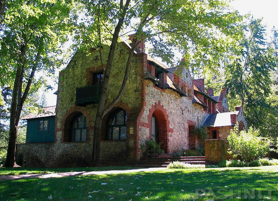
Bourn Mansion at Empire Mine
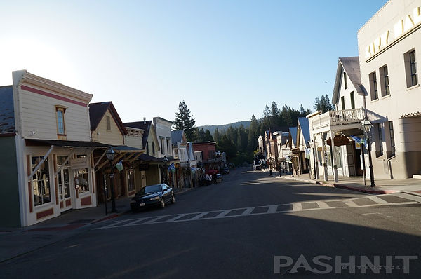
Nevada City
Nevada City was incorporated in 1856 and is a tiny historic town of 3000 with original buildings from the 1850s having been at one time the center of the Nevada County gold industry. The preserved historic buildings make the town very picturesque; the streets have even been the setting for a Hallmark Channel movie. The town is famous of its Victorian Christmas when the streets are closed and the town is decorated in holiday decorations.
There is also a small train museum in Nevada City. Train lovers can check out the Nevada County Narrow Gauge Railroad Museum at 5 Kidder Ct. To stay on Highway 49, it requires paying attention to the signs as the highway turns left here. If you miss the turnoff, Highway 49 converts to Highway 20 and connects to Yuba Pass along Interstate 80.
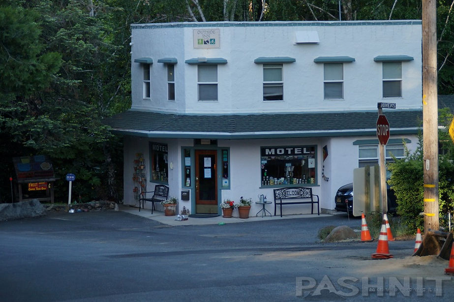
Does it look like a toy model or movie set prop? The Outside Inn in Nevada City
Headed out of Nevada City, first know that Highway 49 needs to make two canyon descents/ascents, first at Hoyt’s Crossing over the South Yuba River, then once more over the Middle Fork of the Yuba River, until it finally joins with the North Fork of the Yuba River into Downieville. That tells you in advance what to expect.
At the junction with Tyler-Foote Rd, 11-miles outside Nevada City, a detour east up the hill will take you along the spine of the ridgeline to North Bloomfield and Malakoff Diggins. If you like ghost towns and local Gold Rush history, this should not be missed. Take note the opposite direction is Birchville Rd providing a shortcut over to French Corral to Pleasant Valley Rd and further down the hill you'll find the longest single span of any surviving wooden covered bridge in the world at Bridgeport
North Bloomfield
Head up the 17-miles along Tyler Foote Crossing Rd to this forested 3,000-acre park, but if possible, plan your visit for when the town is open. And you might even want to check the yearly schedule on the town’s website for when any special events are taking place. It would be a thrill to gain access to buildings that might otherwise be closed.
North Bloomfield is a well-preserved mining town with numerous preserved buildings along the main street. What is unique about it in this part of California is much like Bodie Ghost Town- the town is more of a living museum. Towns along Highway 49 from Downieville down south through Sonora are preserved active towns like Columbia, North Bloomfield is in a state of arrested decay and only reachable by a (paved) dead end road.
As many as 1,500 people lived here during the heyday of the Diggins lasting from the 1850s to 1884. Not only did the town serve as a company town for the miners, but it was the origin of all the supplies needed to extract the gold from the nearby hillside. Giant monitors were built and even a giant sewing machine in the museum was used to create large canvas hoses needed to bring water to the monitors.
North Bloomfield feels stretched out and not as claustrophobic as other gold rush towns, hiking trails surround the town. Several of the tiny buildings have been restored to resemble a day from the 1870s. The drug store shelves are still lined with rows of mysterious elixirs. The general store is still stocked chock full of goods. And one of the restored homes is outfitted to resemble the everyday happenings of the late 1800's.
You can peer through the windows or time your arrival to be in summer when an expertly lead docent tour, every day at 1:30 pm during the summer, will actually take you inside the buildings for a closer look. During the winter, the town is open on weekends.
Behind all the buildings to the south is Humbug Creek. A popular axiom back when the easy gold quickly ran out. The creek today is still panned for gold. Although it is usually by children who've checked out a free gold pan from the park headquarters. Many still find tiny amounts of gold dust.

Tyler-Foote Crossing Rd to Malakoff Diggins SHP

Malakoff Diggins
As the easy placer gold played out and boom became bust during the mid-1850s, miners developed easier ways than panning river banks for placer gold or burrowing into the earth, using high pressure streams of water through a nozzle called a monitor to wash away entire mountain sides while extracting the gold from ancient gravel deposits. The result created a canyon 7000 feet wide and 600 feet deep called Malakoff Diggins. They got the gold- millions of dollars’ worth, but all the sediment & debris washed into the Yuba River System settling out in the Central Valley below.
In the late 1860s, sediment became so deep, ships could no longer navigate the rivers in the Sacramento Valley. River bottoms began to fill up with sedimentary deposits from the water monitors in the hills above. Downstream orchards, grain fields and entire towns were buried under 25 feet of mud & rivers easily flooded during spring snow melt. Wooden towns simply floated away- along with livestock, the picket fence & even the wood pile out back.
Yet water monitors worked 24 hours a day washing away mountainsides to reach the gold. Tired of the flooding, farmers organized to fight against the hydraulic mining companies. By 1880, even San Francisco Bay began to fill up with silt. Hydraulic mining ended up being the first ecological lawsuit ever filed against mining companies responsible for creating the disaster. Hydraulic mining was finally outlawed in 1884, yet the scar is still etched into the surrounding hillsides and still visible today outside the town of North Bloomfield, now a state park.
If you made the detour up to North Bloomfield, take a hint with a shortcut back to Highway 49 via Oak Tree Rd which will pop out at North San Juan.

Oak Tree Rd connects Tyler-Foote Crossing Rd to Highway 49 at North San Juan
Back at Sweetland along Highway 49, this was originally a placer mining camp first settled in the early 1850's, take a hint at another fun detour: Sweetland Rd parallels Highway 49 from Sweetland to North San Juan to the west side of the highway, assessable from Pleasant Valley Rd. Sweetland Rd should likely be avoided by most, it’s single lane paved into North San Juan, but after you’re stuck in weekend traffic one-too-many times, you may want to know about the alternatives.
Riding Highway 49 downhill, it’s worth mentioning a rider could exit Highway 49 at North San Juan, take Sweetland Rd over to Pleasant Valley to Bridgeport Covered Bridge and ride all the way back down to Loomis via the aforementioned (reversed) route above, or connect with Highway 20 at Penn Valley and drop down into Marysville while avoiding all the main roads. The closer you get to Nevada City, the more the traffic increases, especially on the weekends.
North San Juan
North San Juan is a tiny hilltop community of barely 250 people, and the last stop before descending into the swimming holes in the canyons. North San Juan was founded around 1853 not by Spanish Californians, as the name might allude, but by Christian Kientz, an immigrant of German ancestry. He thought the hill resembled another place known as San Juan and named the new spot accordingly. North San Juan is often a chokepoint for traffic to make it through this short stretch of road on weekends. There’s a small eatery, The Ridge Café, and if that’s closed, a small deli is next door along with a tavern for eats. I often see Highway Patrol sitting in this small town, checking out the weekenders as they head up and down to the swimming holes in the canyons.

North San Juan

North San Juan Methodist Church
There’s a tiny pioneer church here, the North San Juan Methodist Church. Built in the Greek Revival style of architecture common during the Gold Rush, the building is worth checking out at 10090 Flume Street two blocks off Main Street. The church was built in 1856 and is still standing over 160 years later. Plaque out front reads: One of the oldest of this faith in continuous operation in California. Escaped three major fires which destroyed the town. The Rev. H. B. Sheldon first assigned Pastor. Rode circuit from Brandy City to French Corral on horseback.
Worth noting, at the eastern edge of town is Oak Tree Rd, this is a shortcut back up to Tyler-Foote Crossing Rd. Ridden downhill from Malakoff Diggins, Oak Tree Rd is a shortcut over to Highway 49. Dual sports take note, Oak Tree Rd continues south as Purdon Rd when it hits Tyler-Foote Crossing Rd, but degrades to a single lane paved road to a single lane gravel road to a steel truss bridge with a wooden deck across the South Yuba River. There aren’t many wood bridges left in the Sierra Nevada, and this might be of interest to the dual sport riders or the Bridge Hunters club.
Lake Vera Purdon Rd eventually connects near the Old Nevada City Airport Open Space back to Highway 49. Further upstream is North Bloomfield Rd, also gravel, that connects Nevada City with North Bloomfield at Malakoff Diggins. Years ago, I rode this gravel road out of North Bloomfield on my Yamaha FJ1200 too stubborn to turn back to the paved road. 'I wonder where this road goes' was the mantra in my younger days. This is an alternate route that parallels Highway 49.

Moonshine Rd provides a twisty connector with Highway 49 & Bullards Bar Dam
Moonshine Rd
Highway 49 drops into the middle fork of the South Yuba River then heads back up. Moonshine Rd is here at the bridge. Moonshine Rd is a paved road with center line for the majority and is in fair condition, it makes for a desirable 5-mile shortcut over to Marysville Rd to Bullards Bar Reservoir.
Another tip: On the west side of Bullards Bar Reservoir is Oregon Hill Rd. This is a shortcut over to Challenge and La Porte Rd; however, Oregon Hill Rd used to be one of the most poorly paved roads in the Sierra Nevada comparable to Sheep Ranch Rd at Murphys. But, it's been re-paved. The crazy bumpy stuff is gone. In the middle of Oregon Hill Rd is Moran Rd, a sort of paved single lane goat trail that flows right into the lake. Otherwise, you have to drop even further down in elevation to circle around back to La Porte Rd and Challenge.

Moonshine Rd connects to Bullards Bar Reservoir

Oregon Hill Rd connects Bullards Bar Rd with Challenge - and La Porte Rd

Pavement in the canyon sections of Highway 49 is dreamy smooth
Oregon Creek Covered Bridge
At the Yuba River next to Moonshine Rd is also the Oregon Creek Covered Bridge dating back to 1860. This covered bridge was built for the stage coach road to Alleghany. The old route is still there as a gravel road although nearby Ridge Rd is paved to Allegheny. The bridge has a length of 101 feet and is currently open to vehicular traffic.
In 1883, the English Dam failed (some claimed sabotage) near present-day Jackson Meadows Reservoir and sent a flood of water downstream.

Oregon Creek Covered Bridge is one of oldest covered bridges still in daily use
The deluge washed the bridge 150 feet downstream off its moorings and spun it 180 degrees around. The way it was built is the opposite of the way it sits today. The bridge was added to the National Register of Historic Places in 1975 and was refurbished in 2018. The 1860 construction makes it one of the oldest covered bridges in the western United States still in daily use.
From the Oregon Creek Covered Bridge, Allegheny Ridge Road (gravel) connects to Ridge Rd (paved) and heads to the east connecting into Henness Pass Rd. This is one of the last unpaved passes in the Sierra Nevada. In the last 20 years, the state has paved La Porte Rd and Wentworth Springs Rd so I’ll keep my hopes up Henness Pass will be paved in my lifetime. The 14-mile middle portion of Henness Pass is gravel, better suited for the dual sport with a detailed map of the area. Henness Pass sits in-between Highway 49 and Interstate 80 but runs along the spine of Lafayette Ridge.

Oregon Creek Covered Bridge
Ridge Rd & Allegheny
Two miles from the Yuba River is Ridge Rd into Celestial Valley, home to the former Walker Mill. Ridge Rd is a super-twisty climb up the ridgeline. Pavement on Ridge Road lasts 22 miles and you’ll find minimal traffic due to this being a dead end if you want to stay on pavement.

Ridge Rd provides access to the mountain communities of Pike and Allegheny. With a population of 60, Allegheny is a tiny gold rush town at the end of a dead-end road. Named in 1855 when gold was found here as early as 1851 and miners began tunneling into the hillsides. The town drew its name from the Alleghany drift, so christened by the company of Pennsylvania miners driving it. The name is thought to originate from the Allegheny River in Pennsylvania.
The Sixteen to One Mine in Allegheny is said to still be in continuous operation since 1896 and has produced well over 1 million ounces in gold. The unusual name was in reference of the silver/gold ratio for U.S. coinage promised by 1896 presidential candidate William Jennings Bryan. The deepest part of the mine is 3,300 feet from the surface as measured along the inclined Tightener shaft.
During The Great Depression in the 1930s, it continued to be a profitable mine with a workforce of 85 to 100 men. The mine was not closed down, as were many gold mines between 1942 and 1945, and the mine operated with a crew of 45 after World War II up to 1965. The "Sixteen" was the last sustained commercial lode-gold mining operation in California.
Alleghany was also the last California community where the economy was based chiefly on gold mining. As recently as 1993, 2600 ounces of gold were recovered in two separate finds, worth $5M at present-day gold prices. While gold production in Allegheny has slowed once more, the USGS projects that about 20,000 tons of gold remain undiscovered in the USA, with another 16,500 tons having been identified but not mined. Overall, ninety million dollars in gold came from the Alleghany area.

The gold bearing regions of the Sierra Nevada often refer most commonly to placer gold, this type of gold was most easily found during the (early) 1850s Gold Rush, and found on sand bars along the inside bends of the many mountain streams and rivers flowing out of the Sierra Nevada range. The presence of placer gold also meant a vein of gold was upstream somewhere as the placer gold did not originate from that riverbank location. Prospectors followed mountain streams into the Sierra Nevada until the placer gold played out along the banks of these rivers. At the source or origin of these mountain rivers, they found Lode Gold. This type of gold wasn’t found along a river bank, but rather as a vein of rock deep underground.
Through geologic processes millions of years ago, a gold vein forms in rock. The vein might be 20 feet underground and far upstream. Over time, natural erosion takes place breaking down the vein and eroding away at the hard rock breaking down the vein and washing the nuggets of gold downstream. Heavy rain events slowly transport this gold down the river tumbling and smoothing the nuggets over millions of years eventually becoming placer gold and settling out in these sand bars or even at the bottom of waterfalls.
The gold mining in Allegheny for the past 170 years has been for lode gold. As the 1850s Gold Rush progressed and the easy placer gold played out, miners began following the source of the gold upstream until the placer gold stopped. Tracing the gold upstream to the source was a good indicator of lode gold embedded in quartz at that location.
Hilltops like Allegheny soon became hives of activity engaging in hard rock mining. Empire Mine is another nearby hilltop that engaged in hard rock mining, while nearby Malakoff Diggins utilized hydraulic mining employing monitors to reach gold found in layers of sedimentary gravel.
Henness Pass
When the pavement on Ridge Rd ends 22 miles in, this becomes Henness Pass Rd, and it’s another 14 miles of gravel mountain road gaining 2000 feet in elevation to reach Jackson Meadows Reservoir at the 6100 ft level to rejoin pavement. Henness Pass Rd connects back to Highway 89 north of Truckee, and pavement begins again at the reservoir.
Jackson Meadows Reservoir releases water in the spring with a dramatic shooting stream of water into the creek. Below the reservoir was the English Dam that failed in 1883. The rush of water from the dam failure was the event that knocked the Oregon Creek Covered Bridge off its moorings. The English Dam was never rebuilt.
Riding downhill from Jackson Meadows Reservoir, the start of Henness Pass Rd (FR S301) is on the east side of the earthen dam through Bear Valley then along the banks of Milton Reservoir, el 5690 ft. There are terrific views of the Sierra Crest and English Mountain.
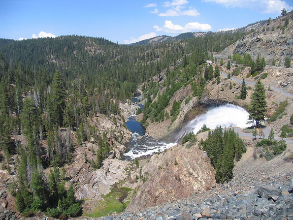
Spring release of water from Jackson Meadows Reservoir on Henness Pass

New Bullards Bar Dam
New Bullards Bar Dam
Two miles after the Oregon Creek Covered Bridge, you'll see signs for Highway E20, aka Marysville Road and Dobbins 15 miles distant via Marysville Rd. The Yuba River Ranger station is here at the intersection providing any information you may need about wandering around the mountain landscape that surrounds in all direction.
Heading west to Bullards Bar Dam will take you to Oregon Hill Rd up to Challenge and over to Oroville, and either Quincy-Oroville Rd or La Porte Rd. The North Complex Fire in 2020 burned over 305,000 acres in Plumas County including the eastern end of La Porte Rd.
New Bullards Bar Dam was conceived after a flood in 1955 spurred legislation to create a new dam on the Yuba River. In 1959, construction began and was finished in the late 1960s creating Bullards Bar Reservoir spanning 4800 acres. Bullards Bar Dam is considered one of the tallest dams built at the time at 645 feet high and a span of nearly a ½ mile long to ride across the arc.

Camptonville
Another two miles on up to Camptonville, corners in this stretch along the Yuba River are smooth and relaxed for the next 23 miles to Downieville, perfect for a spirited romp or a relaxed afternoon ride. Elevation change is minimal which means no switchbacks. The highway here is only at the 3000-foot level, and it feels as though the climb into the mountains hasn’t even begun yet.
At Camptonville, there is fuel here at the edge of town along Highway 49. Camptonville is offset from Highway 49 and the highway bypasses the town completely. In 1850, J.M. Campbell built a hotel, the Nevada House, near here and by 1854, the small mining camp was named for the town blacksmith Robert Campton.

Downieville
Plan for taking a break when you descend into the valley that holds Downieville. Originally known as ‘The Forks’, referring to the confluence of the Downie River and the North Fork of the Yuba River, the two rivers combine here.
Named after Major William Downie, a Scottish explorer and prospector. After arriving in San Francisco in June 1849, Downie led an expedition of one Irish sailor and seven African American sailors into the northern gold fields. Arriving at the confluence of these two rivers in September 1849, it was said that they found gold so plentiful on the banks of the river, a shovel was not required. A community quickly sprang up as the Downie Expedition built a cabin and waited out the winter of 1849. By the following year of 1850, there were 15 hotels, 4 bakeries, 4 butcher shops, and a requisite number of saloons.
Downieville today is a small town full of gingerbread Victorian homes, and is also a haven for bicyclists as vans will haul you up the mountain and you can coast down. Walk the streets of the little town and imagine 5000 people once lived here. After gold was discovered in 1849, the secret soon got out and the fortune seekers flocked to the area.


Present day Downieville at a population of 325 is the center of the ride on Yuba Pass. There can be snow here into April, but the elevation is low at 3100 feet. There is fuel here and several very small restaurants and small inns. At Nevada Street is the Durgan Bridge built in 1938. The bridge is single lane and you can easily view the confluence of the Downie and Yuba Rivers from here.
Several bits of mining equipment are on display near the bridge at the Two Rivers Café in the center of town on the north side of the bridge. The display includes a 5-stamp press, the devices used to crush gold-bearing quartz rock to extract the gold. A short distance away from the town center is a building for The Mountain Messenger, a weekly newspaper in print since 1853, making it the longest running newspaper in California. Mark Twain once wrote for the paper under his real name, Samuel Clemmons, while hiding out from Nevada authorities. The story goes he accepted a duel after dueling had been outlawed and had to quickly leave town escaping to Downieville.
Town lore also states Downieville was in the running to be the state capital, along with 15 other California cities in 1853 to replace Vallejo. Downieville was California’s 5th largest city by the mid-1850s, but the honor for the capital eventually went to Sacramento. The Downieville population quickly declined by 1865 but has remained as the present-day county seat of Sierra County.
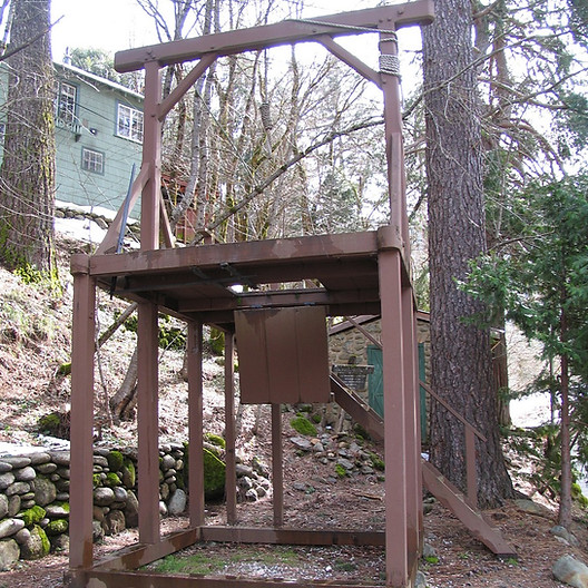
Sierra County Sherriff’s Gallows
On November 27, 1885, 20 year old James O’Neill was hanged from this gallows for the August 7, 1884 murder of Webber Lake dairyman John Woodward. That execution, conducted by Sheriff Samuel C. Stewart approximately 100 feet west of this site, was the last legal execution in Sierra County and the only time these gallows was used. Changes in state law in 1891 ended local executions in California and further changes in 1941 ended hanging as a means of legal executions within the state.
The 1885 gallows were built to be portable, presumably for future use when needed. Disassembled and put away for a later date, the gallows were forgotten until discovered in the attic of the courthouse in 1927 and promptly reassembled.
The gallows can be found on the south side of the river across the Durgan Bridge on Nevada Street at the County Courthouse. James O’Neill wasn’t the first hanging in Downieville, rather the story goes a young Mexican woman named Juanita was found guilty of murder, and promptly hanged that same day from a beam of the bridge over the Yuba River.
Downieville is also full of numerous Victorian-era homes along its narrow city streets and it's worth the stop to walk the streets to view the homes.

Continue on Highway 49 across the narrow one-lane bridge built in 1938 over the Downie River and up the mountain you go. We finally have elevation climb here as the road squiggles back and forth along the river. Further up, ample snow in winter adorns the tops of the surrounding mountains well into spring. This stretch of Highway 49 beyond Downieville also has lots of jeeps headed for the gravel roads.
You may see people down in the Yuba River still fishing for gold with their floating gold dredge. A gold dredge is a placer mining machine that extracts gold from sand, gravel, and dirt using water and mechanical methods. It’s designed like a vacuum cleaner to suck up sand and silt on the river bottom and run the sandy material through a sluice and separate out any gold dust or nuggets.

Sierra City
Twelve miles distant is Sierra City at 4100 feet, a mere 225 people claim this as home. Main Street is a short clip, only a few hundred yards long. Sierra City sits at the base of the 8587 ft. Sierra Buttes. These mountain peaks are 1.6 miles from the town to the north. There is a dirt jeep trail that is carved up the mountainside all the way to the summit, something the dual sport riders may be interested in, the start of this trek is Sierra Buttes Rd in the center of Sierra City.
No fuel here, but there are several small inns, restaurants and an RV Park along with a requisite saloon and town market. Make it your stop for ice cream at the Buckhorn in the center of town. There are no public schools in Sierra City, the kids are bused the 12 miles down the hill to nearby Downieville.
As prospectors followed the placer gold upstream along the banks of the North Yuba River, the easy placer gold stopped at Sierra City and a camp began to grow. An avalanche of snow in the 1852-53 winter destroyed the town burying whatever buildings there were, but Sierra City was later rebuilt at a lower elevation a few years later with a peak population around 3000 by 1860.
Sierra County is sparely populated and the entire county only has 3200 permanent residents spread over nearly 1000 square miles. Between 1848-1860, 16,000 Argonauts settled in Sierra County.
Several hard rock mines were established at the foot of the Sierra Buttes on both sides of the Yuba river. The Sierra Buttes Mine stayed active for 80 years offering steady employment with as many as 290 men working at the mine by 1873.
By 1852, several mines were pushing tunnels into the Sierra Buttes. The Kentucky Mine on the east end of town is now a museum. A five-iron stamp was built to crush the ore pulled from the mine. Later in 1888, another stamp was built doubling capacity. You can also check out California's last original operable gold-ore crushing stamp mill. The mine was operable for over 100 years all the way up to 1953.
Several very large gold nuggets have been found around Sierra City. In 1869, the Monumental Nugget at over 1,800 troy ounces was found here. That's a gold nugget weighing 106 lb. Miners were stepping right over the nugget while walking to work. After a heavy rain exposed the nugget in 1869, miners looked down and saw the glint of gold in the dirt along their path to work. One might assume the gold has all played out, but a gold nugget weighing over 1,500 troy ounces was found in the Monumental Mine in 1960. That’s a 103 lb. gold nugget discovered 60 years ago.


Sierra Pines Resort in Sierra City was the perfect base for our Northern Sierra Crest Pashnit Motorcycle Tour

Sierra Pines Resort in Sierra City has a restaurant on site, with rooms right on the Yuba River
A replica of the 106 lb. Monumental Nugget is on display at the Kentucky Mine Museum (100 Kentucky Mine Rd) which is 1 mile east of the center of town along Highway 49. There’s a small amphitheater at the Kentucky Mine and Museum that seats 200 and hosts occasional musical events. Today, the mine tunnel, the stamp mill, the blacksmith shop and the usual gold mining items are part of the displays. You'll have to catch the museum June through September 10-5 and weekends in October.

Gold Lakes Highway
Five miles east of Sierra City is Gold Lakes Hwy at Bassetts (fuel here). This has to be one of the most scenic and easily missed roads up and over the Sierra Nevada past a series of mountain lakes. I have to admit that in my early forays into the Sierra Nevada several decades ago, I had no idea Gold Lake Hwy was there and blithely stuck to the main highway.
This High Sierra area is known as the "Lakes Basin," a collection of some fifty lakes to the northeast of the towering Sierra Buttes. The largest of them, was named in 1850 when a miner, Thomas Stoddard, claimed he had found a mountain lake whose shores were studded with gold nuggets. The usual rush ensued; more than a thousand hopeful prospectors would set out on an expedition for this lake of gold, and repeated expeditions followed swelled by rumor and hope. Entire towns emptied as Argonauts rushed into the mountains above Downieville. No gold was ever found on those shores. The name however, Gold Lakes, remains to this day.
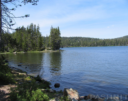

Despite thousands of gold prospectors swarming over the Gold Lakes region, no permanent settlements were ever established as no gold was ever found. Today, this collection of 50 lakes provide the perfect setting for the outdoorsy person who wants to engage in a plethora of outdoor activities.
Each of the larger lakes have small resorts around them, the first option is Sardine Lake with Sardine Lake Resort. Mountain Views of the Sierra Buttes overshadow the lake and the history dates to 1941 while nearby Salmon Lake has the Salmon Lake Lodge, Gold Lake the Gold Lake Lodge and so on.
The Lakes Basin Gold Lake Region is in the north part of Tahoe National Forest, on the border of Plumas National Forest. Plumas Eureka State Park is also nearby to the north. Plumas Eureka State Park is five miles west of Blairsden on County Road A-14. This state park is relatively unknown and easily missed.

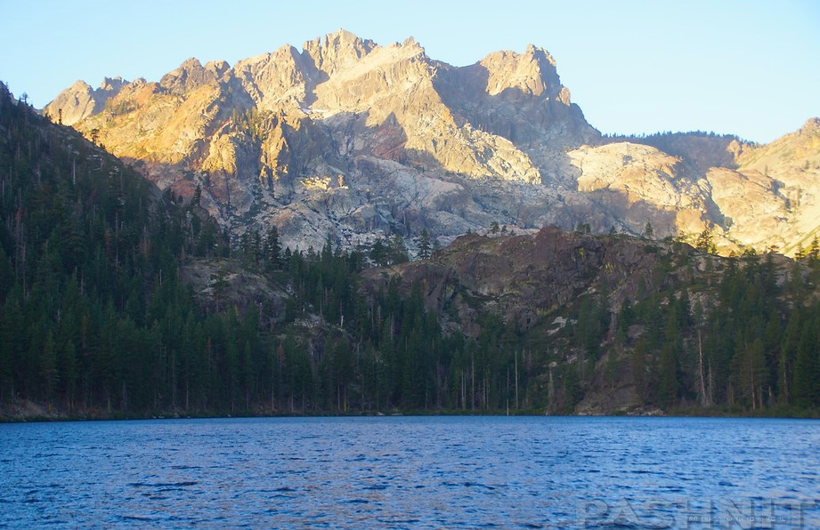
View at Sardine Lake of the Sierra Buttes

Frazier Falls
On the east side of the range along Gold Lakes Hwy is Frazier Falls at the 6000 ft level, reachable via Frazier Creek Rd which parallels Gold Lakes Hwy. This waterfall has a 248 ft drop that provides a welcoming view in spring when the snowmelt is most active. Frazier Falls requires a short 1 mile walk on a paved walking path to view but is easily reachable from the road. The northern half of Frazier Falls Rd is paved, the southern half is hard-pack gravel back to Gold Lakes Hwy. Frazier Creek is the exit point for Gold Lake. If you want to stay on pavement, you’ll need to enter from the northern entry point onto Frazier Creek Rd.
If your general destination is north, then Gold Lakes Drive is a must, the speeds are lower and there is boat traffic, but the scenery is well worth it. The 8857 ft Sierra Buttes with jagged peaks dominating the view from Gold Lakes Drive. With a touch of snow in the high peaks, the view is quite stunning. The Sierra Buttes include a fire lookout high atop the Sierra Range with a 100-mile view in every direction on a clear day. Accessible via a 6-mile hike with an 1800 ft elevation gain, put it on your to-do list.

Frazier Creek Rd to reach Frazier Falls
Gold Lake Hwy joins up with Highway 89 at Graeagle, a retirement community centered around a gold course. Graeagle is small, merely a stop for gas, but we’ve used the restaurant at the Gold Course for lunch with motorcycle tour groups which offers up a more pleasant environment overlooking the course. If you are trying to reach Plumas Eureka State Park, the access road is on the north side of Graeagle.
.
At the summit of 6709 ft Yuba Pass is a large parking area and the adjacent Yuba Pass Campground. This large parking area is a base for cross-country skiing, dog sledding, snow play, and snowmobiling. Snowmobile trails lead into the Sierra Range on the north and south sides of the highway.
Highway 49 begins a steady descent here into the Sierra Valley but the descent is nothing like the cousins to the south Highway 4 and Highway 108. Fast, steady, and smooth are the order of the day through several switchbacks and smooth corners.
Although the Eastern Sierra had a lack of gold, it was perfect for agriculture and ranches sprang up to supply the gold fields with food and meat from cattle raised in these expansive high mountain plateaus.
The descent to Highway 395 includes several wide parking viewpoints overlooking the wide Sierra Valley holding Highway 89 and plenty of ranches. The view through the trees is well-worth a pause in the journey to gaze off across the Sierra Valley. Highway 49 Yuba Pass joins with Highway 89 at the base of the hill and flows into Sattley. This isn’t a town, merely an intersection although there is a small market here. Westside Rd at Sattley provides a quick shortcut over to Beckwourth and avoids all the tourist traffic on Highway 89. Nevada City to Highway 89 is 73 miles in total, and 100 miles from Auburn at I-80. (and another 100 miles back to the start point via Hwy 89/I-80).
One of the best aspects of Yuba Pass is its location on the map. Far enough out there to get away from people in general, but this isn't the middle of nowhere. You're sure to see plenty of other motorcyclists too. Civilization is only a hop, skip, and jump away.


Where to next?
Highway 49 ridden uphill from Nevada City deposits you into the Sierra Valley. There are numerous options for where to next:
SOUTH: Continue south via Highway 89 to Henness Pass Rd. This ‘pass’ is only paved up to Jackson Meadows Lake and there are no extreme twisties on this ride. Jackson Meadows Reservoir at 6100 ft is another man-made reservoir in the Sierra Nevada although in spring when the snow melt fills the lake, the lake empties water in a dramatic release of spraying water. For the dual-sports, join up with Henness Pass Rd all the way back to Highway 49 via Ridge Rd.
Ride into Truckee- about 25 miles away, and over to Lake Tahoe. Note a Circle Tour of Lake Tahoe is always an enjoyable ride if you can ride it when the traffic is light.
NORTH: Combine Highway 49 with La Porte Rd or Oroville-Quincy Highway to create a loop zig zagging back and forth across the Sierra Range. Note this area between La Porte Rd & Oroville-Quincy Hwy burned in the wildfires of 2020. Further north, if you want to stay on main roads, head north to Lake Almanor on Highway 89 toward Mt Lassen. North of Mt Lassen is Burney-McArthur Falls on the way to Glass Mountain.
If you continue east on Hwy 49 through Loyalton, the ride is straight, uneventful and relaxing, or just plain boring- depending on your perspective. Nearby Portola has one of the biggest train museums west of the Rocky Mountains. If you like trains, do check out the Western Pacific Railroad Museum.
Also note that 16 miles away from Graeagle at Beckwourth is Beckwourth Genesee Rd (FR 177) which is a paved road north to Antelope Lake, and connecting all the way to Taylorsville near Highway 89. Forest Road 177 splits near Antelope Lake and Forest Road 172/Janesville Grade connects to Janesville at Hwy 395. This Y-shape route is all paved, and very remote. There are no towns, no civilization of any kind and very few people. The southern 9 miles was recently repaved, but the pavement for the entire length is poor and patched, but it is the only paved road through the northern Sierra Range and no one’s ever heard of it. Beckwourth to Taylorsville is 70 miles. The pavement has slowly gotten worse over the last 20 years since I first rode this route, but it is always a deserted ride. I’ve led several Pashnit Motorcycle Tour groups along this route, but the general consensus from the riders was the pavement was really poor. Despite that, I’ve always loved how remote it is.
Riding along Highway 89, watch out for any Truckee-based CHP. Highway 89 is a main road with the usual share of locals, tourists, and large RVs. Need to extend your ride, then try Nevada's Highway 447 a few miles away across the Nevada border. Don’t ever ride Highway 447 on Labor Day Weekend, that’s when the annual Burning Man Festival takes place at Gerlach in the Black Rock Desert.

Beckwourth Genesee Rd (FR 177) is one of the most remote mountain roads in the far Northern Sierra Range
The mid-section is 20 miles of gravel

Beckwourth Genesee Rd (FR 177) connects Portola with Lake Antelope, it used to be paved.
Highway 49 - Photo Gallery


MORE INFO: Highway 49 Yuba Pass
RIDE IT on a PASHNIT TOUR
73 Miles Nevada City to Graeagle - LENGTH
Well-maintained - PAVEMENT
Steep hairpins, numerous - CURVES
Numerous - LODGING
6709 ft- PEAK ELEVATION
GPS LOCATION
- Nevada City
- Downieville
- Graeagle
LISTED CONNECTING SIDEROADS:
Pleasant Valley Rd
Sweetwater Rd
Moonshine Rd
Oak Tree Rd
Ridge Rd / Henness Pass Rd
Gold Lakes Hwy

Maps
