Central Sierra Foothills Day Ride
- Tim Mayhew

- Dec 25, 2022
- 8 min read
Updated: Dec 31, 2022
Ride with Pashnit on a 350-mile day ride exploring the Sierra Nevada Foothills from Three Rivers to the Crystal Range Basin near Lake Tahoe.
Roads on this ride: Dry Creek Rd, Highway 245, Millwood Rd, Elwood Rd, Trimmer Springs Rd, Maxon Rd, Auberry/Powerhouse Rd, Highway 49 - The Little Dragon, (skips 120 miles north), Ice House Rd, Wentworth Springs Rd

Up before the sun and on the bike before everyone wakes up for a 350-mile day ride through the Sierra Nevada Foothills starting in Central California's Tulare County at Lake Kaweah (near Three Rivers) and making my way north all the way to Ice House.
Lake Kaweah in the dim light of daybreak. The Kaweah River originates in the Sierra Nevada and drains about 560 sq mi into Lake Kaweah before flowing towards the San Joaquin Valley.

On the western edge of Lake Kaweah is Dry Creek Rd. This goaty 18-mile alternative flows up a deserted canyon and re-joining with Highway 245 at Mountain House. Single lane & remote. Highway 245, parallel to the west, is faster and more twisty, but after many times of riding it, you'll be asking what else do they have round these parts?

This shot below from a previous ride, Highway 245 is super twisty and one of the most curvy roads in the state no one has ever heard of.

The answer to the above: Backroads, we have single lane backroads.

Not a lot of traffic at daybreak.


Dry Creek Rd wiggles on up to Mountain House. And yes, the creek was dry.

Mountain House is little more than a saloon in a hairpin corner along Highway 245.

Not very busy today...

The 2020 Sequoia Complex Fire edged into the Foothills and was stopped along Highway 245. The burn scar crosses the highway in several places.

View across the Sierra Nevada Foothills from Highway 245.

No guard rails anywhere and it's a long way down.

The northern-most 6 miles of Highway 245 nearing Highway 180 climbs rapidly in elevation as the highway pushes past the 5000-foot level and rises into the Sequoia National Forest flowing through the mountain communities of Pinehurst and Etheda Springs.

Kings Canyon & Sequoia National Parks are a few miles away from the northern terminus of Highway 245.

You could easily zip down the hill on Highway 180 into the Central Valley, but who wants that? More twisty roads please.

Millwood Rd isn't long, about 7 miles. But it connects Highway 180 with Dunlap & parallels Highway 180 and the twisty Dunlap Rd. Today, I'm riding it downhill from Hwy 180 to Dunlap.

The views are all southward across the Sierra Foothills.

Millwood Rd is one of these roads that no one has ever heard of. Single lane, deserted, and parallel to a main highway ensures it gets little notice & is easily missed.


How do you find these roads? I have a Benchmark Maps Road Atlas of the state. It's 140 pages of maps just of California, and I go grid square, by grid square, across all 140 pages looking for paved roads I have not ridden wondering how I could incorporate them into a Pashnit Motorcycle Tour. You asked.

But, if you like backroads as much as I do, it's narrow, & wiggly fun. Millwood Rd drops down from Highway 180 and splits into the eastern leg (Todd Eyemann Rd) headed for Cedar Brook (along Highway 245) or the western leg into Dunlap. We're riding the western leg.

The view from Millwood Rd is perfect as the first rays of the sun begin to come over the Sierra Nevada Range & illuminate this valley. On the opposing ridgeline barely visible is a thin line - that's Dunlap Rd from Dunlap to Miramonte, very fun, very twisty road with very good pavement. Dunlap Rd connects to the super-twisty Highway 245.

Sand is everywhere. I always tell my riders: There are no surprises in riding. You should always expect the sand to be there.

The thin line on the opposing ridgeline in the distance is Dunlap Rd.


First rays of the sun break over the Sierra Range on Millwood Rd above Miramonte. I've been doing so many of these pre-dawn rides, this has become a signature photo of these rides.


After an hour of brisk morning temps, it was time for a break.

Millwood Rd has this massive whale-sized rock perfectly balanced above what becomes a waterfall during spring snowmelt. How did this massive rock get here placed so perfectly? Glaciers. During the last Ice Age which ended approximately 10,000 years ago, this rock was likely placed here by massive sheets of ice flowing out of the Sierra Nevada Range.

The times we've stopped here with the Pashnit Tour group along Millwood Rd.

I've been known to move mountains.

During spring snowmelt, this spot produces a small waterfall. The sound is divine.

Today it was dry, and quiet. Note the sand.

Did not see a single other person the entire time along this road.


So long Mr. Whale, until next time, but I must be movin' on.

As the elevation drops, Millwood Rd rolls past bucolic farms surrounded in green meadows. Don't let the spring green fool you, that cacti on the right basks in the hot dry summers.

All this spring green fades to golden brown when summer arrives & the cacti is then happy.

Elwood Rd is one of those hidden gems you'd prefer to keep to yourself. Showing it off to other riders has become a staple of any Central Foothills Pashnit Tour over the last 20+ years. Then a few years back, it was repaved, and we were in love all over again.

Elwood Rd connects Highway 180 and Piedra at the base of Pine Flat Reservoir.


It's short, it's quick, it's twisty, it drops about 1000 ft. in elevation in a few miles flowing into Tretten Canyon & then into Wonder Valley.


Ride this uphill and it's super fun!

Pine Flat Dam, in the distance, holds back the Kings River and stores the water in Pine Flat Lake.

Elwood Rd is a shortcut over to Piedra, and then connects with Trimmer Springs Rd along the northern edges of Pine Flat Lake adhering to the contours of the reservoir.

Trimmer Springs Rd is endless twists and turns.

At certain times of the year, these little guys are everywhere.

But seeing them, always reminds me of this movie, Kingdom of the Spiders, I saw as a kid. Scary stuff back then. Not exactly a kids movie. William Shatner, as in Star Trek, was the lead role.

Trimmer Springs Rd continues around the lake, but Maxon Rd is a shortcut northward.

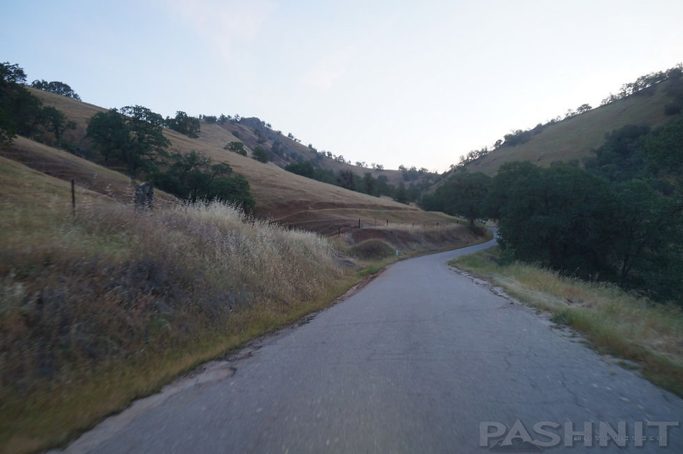
Maxon Rd is a single-lane remote ranch road, but it's paved. Sometimes, you have to dodge cows as this is open range.

I had to make time on this ride running up Tollhouse and skipping north to Auberry riding down into the San Joaquin River Canyon to the AG Wishon Powerhouse.

Auberry Rd connects to North Fork, via the San Joaquin River Canyon, then we hop on Road 223 to reach Highway 49 at Oakhurst.

The AG Wishon Powerhouse was constructed in 1910 and has four turbines inside. Giant pipes known as penstocks that are three feet in diameter and nearly a mile long feed water into the four turbines.

Auberry Rd connects to North Fork, the geographical center of California. This range in the distance is Mammoth Pool Rd, which leads to Mile High Vista. Another day.

North of Mariposa, I'm headed for The Little Dragon.

The Little Dragon, is a stretch of road along Highway 49 that involves an endless stream of twists and turns. Recently repaved, it's delightful, fast, and a long way down.

The Detwiller Fire in July 2017 burned 80,000 acres and burned out the entire Merced River Valley that The Little Dragon sits in, but the hillsides are green again a few years later.

The hillsides around Bear Valley recover quickly after a wildfire that burned this valley a few years ago.

If you look closely at the below shot, you can see Highway 49 twist out of the valley on the far side of the Merced River in the canyon below. The bathtub ring is from Lake McClure which extends this far upriver during wet years.


Highway 49 is non-stop curves as it nears Moccasin. I rode the length of The Little Dragon & saw one other vehicle. I had all these curves to myself. My pre-dawn departure meant it was 9 am on a Sunday when I reached this stretch of curves.

The ride from Coulterville to Moccasin is non-stop curves. At Moccasin is Old Priest Grade which leads to Highway 120 - Tioga Pass & Yosemite National Park.


The goal of today's ride was to skip north 120 miles and run up Ice House Rd through the Crystal Basin.

Below image shows the ride from Highway 50 to Big Hill Fire lookout and then continuing to the junction with Ice House through the Crystal Basin. The Crystal Basin spans about 85,000 acres north of Highway 50 and west of the Desolation Wilderness. Ice House and Wentworth Springs Roads are the two paved (main) roads that run through this region of the Sierra Nevada Range.


Heading deeper into the Sierra Nevada Range and bumping over 6000 ft.

Ice House Rd is one of my favorite rides, I used to live 9 miles away from this road. It was the closest curvy mountain road to my house.


Ice House Rd is wide-open non-stop mountain curves as it climbs out of the American River Canyon that holds Highway 50 to South Lake Tahoe.

Highway 50 is down in the American River Canyon below, but hints of snow are seen at the 7000 ft level on nearby mountain tops.

Views of Highway 50 headed for South Lake Tahoe. The river below is the South Fork of the American River.


The best part of Ice House Rd is the ride up to the Big Hill Fire Lookout. This hilltop overlooks the entire Crystal Basin.

My ride was too early in the season for the Fire Lookout to be open, but it will be soon. It's open to the general public who are welcome to climb up the steep stairs into the lookout.
Originally built by the California Conservation Corps in 1933/34, this lookout was used for the detection of wildfires each summer until September 1992 when the Cleveland Fire destroyed the wooden structure. It was also used year-round during World War II years for the detection of high altitude balloons carrying Japanese fire bombs attempting to set the west coast of the United States aflame. The current lookout was built in 1994 on top of the original steel frame.

Northern view from Big Hill Fire Lookout, that lake down there is Union Valley Reservoir.

The Crystal Range to the east, the tallest peak at right is Pyramid Peak. On the other side of this range is Lake Tahoe.

Looks like the perfect place to have a picnic lunch.

I didn't see one other person the entire time I was at Big Hill. I had this mountain top all to myself.


The photos don't show it, but the wind was blowing, the temps were in the 40s, and it was cold. It was time to run back down into the forest and hide from the wind racing across these mountaintops.
The High Sierra has been known to produce winds over 140 mph over tops of these peaks.

My goal, was to ride back down the hill via Wentworth Springs Rd. It was a gamble this early in the ride season, the snow may not melt till June during some years, But there has been very little snow this last winter, so it was worth the gamble.

At the 21-mile mark from Hwy 50, you’ll ride up on Robbs Peak Rd to Robbs Hut atop Robbs Peak at 6686 ft. It’s a short unpaved fire road for 6 miles to a locked gate. You then have to hike about 3/4 mile the rest of the way if you opted to ride up to the gate. Robbs Peak Rd is found in a long downhill straight, and easy to blow by if you’re not watching for it. The hut can be rented, reserve online at recreation.gov. The ride up to Robbs Hut may have to wait for another day.
This is the start of Robbs Peak Rd.


Around the corner, is Wentworth Springs Rd.

The plan: Looks tasty!

Arriving at the east end of Wentworth Springs Rd.

Wandering around the mountains during spring may involve a bit of snow. And luck.

How far up the road could I get?


Denied. Wentworth Springs Rd will have to wait.


Don't worry. I was back on Wentworth Springs Rd 30 days later, no snow, with a Pashnit Tour group and Wentworth was magical.

Learn more about multi-day tours with Pashnit Motorcycle Tours or discover many more curvy roads on Pashnit.com's California Motorcycle Roads.


Comments